You are here: Home > Network List > IU - Global Seismograph Network (GSN - IRIS/USGS) Stations List
> Station CTAO Charters Towers, Australia > Earthquake Result Viewer
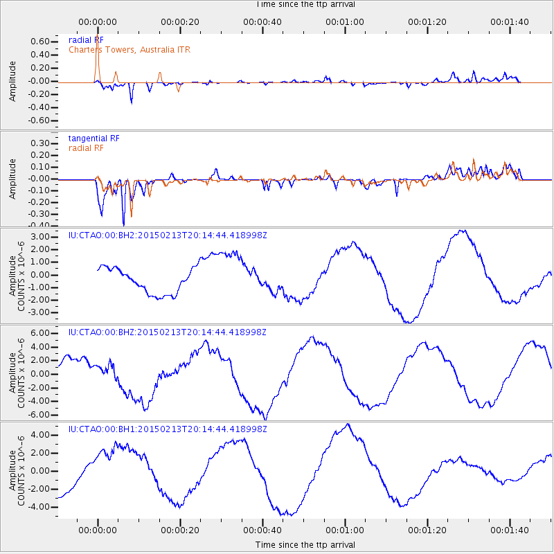
CTAO Charters Towers, Australia - Earthquake Result Viewer
*The percent match for this event was below the threshold and hence no stack was calculated.
| Earthquake location: |
Taiwan Region |
| Earthquake latitude/longitude: |
22.6/121.4 |
| Earthquake time(UTC): |
2015/02/13 (044) 20:06:31 GMT |
| Earthquake Depth: |
24 km |
| Earthquake Magnitude: |
6.2 MWW, 6.1 MWR, 6.3 MWC |
| Earthquake Catalog/Contributor: |
NEIC PDE/NEIC COMCAT |
|
| Network: |
IU Global Seismograph Network (GSN - IRIS/USGS) |
| Station: |
CTAO Charters Towers, Australia |
| Lat/Lon: |
20.09 S/146.25 E |
| Elevation: |
357 m |
|
| Distance: |
48.9 deg |
| Az: |
148.406 deg |
| Baz: |
329.001 deg |
| Ray Param: |
$rayparam |
*The percent match for this event was below the threshold and hence was not used in the summary stack. |
|
| Radial Match: |
83.98168 % |
| Radial Bump: |
400 |
| Transverse Match: |
93.74287 % |
| Transverse Bump: |
377 |
| SOD ConfigId: |
872571 |
| Insert Time: |
2015-02-27 20:24:00.610 +0000 |
| GWidth: |
2.5 |
| Max Bumps: |
400 |
| Tol: |
0.001 |
|
Signal To Noise
| Channel | StoN | STA | LTA |
| IU:CTAO:00:BHZ:20150213T20:14:44.418998Z | 0.61596876 | 1.1779089E-6 | 1.9122865E-6 |
| IU:CTAO:00:BH1:20150213T20:14:44.418998Z | 1.685346 | 2.7340807E-6 | 1.6222666E-6 |
| IU:CTAO:00:BH2:20150213T20:14:44.418998Z | 2.2192822 | 2.1448038E-6 | 9.664404E-7 |
| Arrivals |
| Ps | |
| PpPs | |
| PsPs/PpSs | |


