You are here: Home > Network List > TA - USArray Transportable Network (new EarthScope stations) Stations List
> Station L04D Klamath Falls, OR, USA > Earthquake Result Viewer
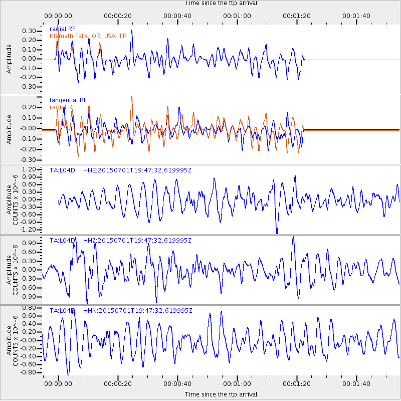
L04D Klamath Falls, OR, USA - Earthquake Result Viewer
*The percent match for this event was below the threshold and hence no stack was calculated.
| Earthquake location: |
Solomon Islands |
| Earthquake latitude/longitude: |
-11.0/162.6 |
| Earthquake time(UTC): |
2015/07/01 (182) 19:35:21 GMT |
| Earthquake Depth: |
8.9 km |
| Earthquake Magnitude: |
5.8 MO |
| Earthquake Catalog/Contributor: |
NEIC PDE/NEIC ALERT |
|
| Network: |
TA USArray Transportable Network (new EarthScope stations) |
| Station: |
L04D Klamath Falls, OR, USA |
| Lat/Lon: |
42.22 N/122.30 W |
| Elevation: |
1437 m |
|
| Distance: |
86.5 deg |
| Az: |
45.995 deg |
| Baz: |
251.942 deg |
| Ray Param: |
$rayparam |
*The percent match for this event was below the threshold and hence was not used in the summary stack. |
|
| Radial Match: |
49.1078 % |
| Radial Bump: |
400 |
| Transverse Match: |
52.167034 % |
| Transverse Bump: |
366 |
| SOD ConfigId: |
7422571 |
| Insert Time: |
2019-04-19 13:56:04.023 +0000 |
| GWidth: |
2.5 |
| Max Bumps: |
400 |
| Tol: |
0.001 |
|
Signal To Noise
| Channel | StoN | STA | LTA |
| TA:L04D: :HHZ:20150701T19:47:32.619995Z | 2.8255196 | 4.2652093E-7 | 1.509531E-7 |
| TA:L04D: :HHN:20150701T19:47:32.619995Z | 2.6440854 | 4.9877644E-7 | 1.8863857E-7 |
| TA:L04D: :HHE:20150701T19:47:32.619995Z | 2.0311553 | 5.942868E-7 | 2.925856E-7 |
| Arrivals |
| Ps | |
| PpPs | |
| PsPs/PpSs | |


