You are here: Home > Network List > UW - Pacific Northwest Regional Seismic Network Stations List
> Station MRBL Marblemount, WA, USA > Earthquake Result Viewer
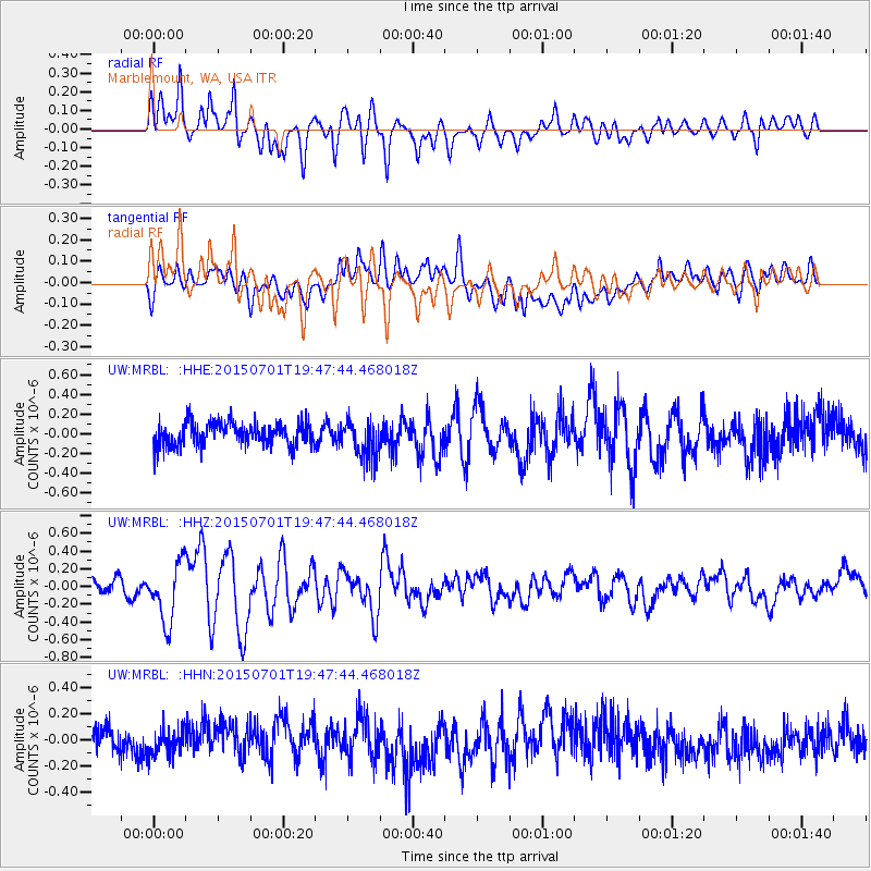
MRBL Marblemount, WA, USA - Earthquake Result Viewer
*The percent match for this event was below the threshold and hence no stack was calculated.
| Earthquake location: |
Solomon Islands |
| Earthquake latitude/longitude: |
-11.0/162.6 |
| Earthquake time(UTC): |
2015/07/01 (182) 19:35:21 GMT |
| Earthquake Depth: |
8.9 km |
| Earthquake Magnitude: |
5.8 MO |
| Earthquake Catalog/Contributor: |
NEIC PDE/NEIC ALERT |
|
| Network: |
UW Pacific Northwest Regional Seismic Network |
| Station: |
MRBL Marblemount, WA, USA |
| Lat/Lon: |
48.52 N/121.48 W |
| Elevation: |
75 m |
|
| Distance: |
89.0 deg |
| Az: |
40.172 deg |
| Baz: |
252.299 deg |
| Ray Param: |
$rayparam |
*The percent match for this event was below the threshold and hence was not used in the summary stack. |
|
| Radial Match: |
74.846634 % |
| Radial Bump: |
400 |
| Transverse Match: |
67.235245 % |
| Transverse Bump: |
400 |
| SOD ConfigId: |
7422571 |
| Insert Time: |
2019-04-19 13:57:02.788 +0000 |
| GWidth: |
2.5 |
| Max Bumps: |
400 |
| Tol: |
0.001 |
|
Signal To Noise
| Channel | StoN | STA | LTA |
| UW:MRBL: :HHZ:20150701T19:47:44.468018Z | 4.5048995 | 3.3345574E-7 | 7.402068E-8 |
| UW:MRBL: :HHN:20150701T19:47:44.468018Z | 0.8915652 | 9.7028085E-8 | 1.0882892E-7 |
| UW:MRBL: :HHE:20150701T19:47:44.468018Z | 1.6951652 | 1.9480603E-7 | 1.1491861E-7 |
| Arrivals |
| Ps | |
| PpPs | |
| PsPs/PpSs | |


