You are here: Home > Network List > TA - USArray Transportable Network (new EarthScope stations) Stations List
> Station K61A Williamstown, MA, USA > Earthquake Result Viewer
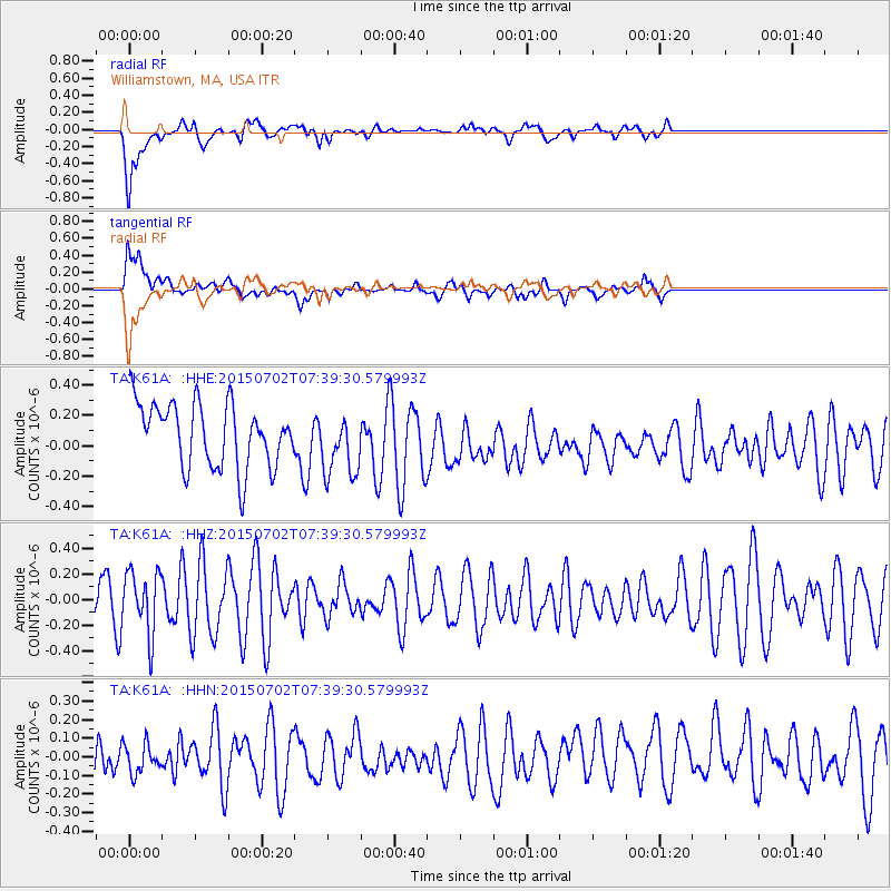
K61A Williamstown, MA, USA - Earthquake Result Viewer
*The percent match for this event was below the threshold and hence no stack was calculated.
| Earthquake location: |
Southern Mid-Atlantic Ridge |
| Earthquake latitude/longitude: |
-34.7/-16.2 |
| Earthquake time(UTC): |
2015/07/02 (183) 07:26:49 GMT |
| Earthquake Depth: |
10 km |
| Earthquake Magnitude: |
5.7 MB |
| Earthquake Catalog/Contributor: |
NEIC PDE/NEIC ALERT |
|
| Network: |
TA USArray Transportable Network (new EarthScope stations) |
| Station: |
K61A Williamstown, MA, USA |
| Lat/Lon: |
42.67 N/73.27 W |
| Elevation: |
391 m |
|
| Distance: |
93.0 deg |
| Az: |
321.683 deg |
| Baz: |
136.156 deg |
| Ray Param: |
$rayparam |
*The percent match for this event was below the threshold and hence was not used in the summary stack. |
|
| Radial Match: |
69.72533 % |
| Radial Bump: |
400 |
| Transverse Match: |
54.77896 % |
| Transverse Bump: |
400 |
| SOD ConfigId: |
7422571 |
| Insert Time: |
2019-04-19 14:11:15.622 +0000 |
| GWidth: |
2.5 |
| Max Bumps: |
400 |
| Tol: |
0.001 |
|
Signal To Noise
| Channel | StoN | STA | LTA |
| TA:K61A: :HHZ:20150702T07:39:30.579993Z | 1.2409339 | 2.4312337E-7 | 1.9591968E-7 |
| TA:K61A: :HHN:20150702T07:39:30.579993Z | 0.75212145 | 7.915136E-8 | 1.0523748E-7 |
| TA:K61A: :HHE:20150702T07:39:30.579993Z | 0.94601625 | 1.9071199E-7 | 2.0159484E-7 |
| Arrivals |
| Ps | |
| PpPs | |
| PsPs/PpSs | |


