You are here: Home > Network List > TA - USArray Transportable Network (new EarthScope stations) Stations List
> Station M53A WI Miller and Sons, Farmdale, OH, USA > Earthquake Result Viewer
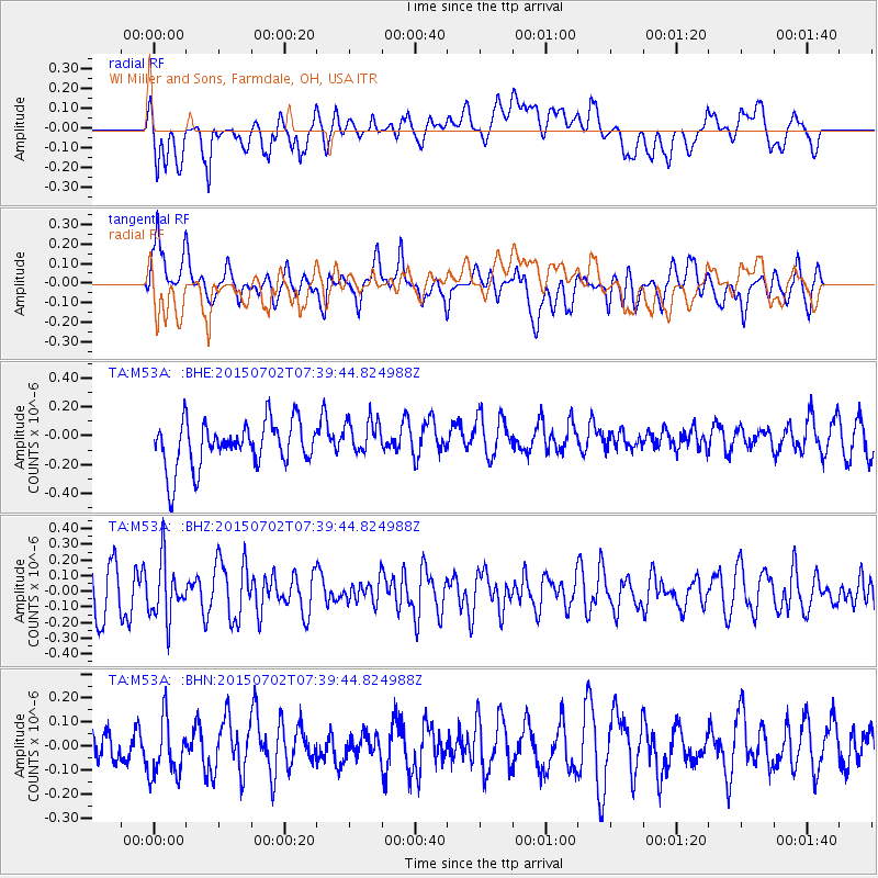
M53A WI Miller and Sons, Farmdale, OH, USA - Earthquake Result Viewer
*The percent match for this event was below the threshold and hence no stack was calculated.
| Earthquake location: |
Southern Mid-Atlantic Ridge |
| Earthquake latitude/longitude: |
-34.7/-16.2 |
| Earthquake time(UTC): |
2015/07/02 (183) 07:26:49 GMT |
| Earthquake Depth: |
10 km |
| Earthquake Magnitude: |
5.7 MB |
| Earthquake Catalog/Contributor: |
NEIC PDE/NEIC ALERT |
|
| Network: |
TA USArray Transportable Network (new EarthScope stations) |
| Station: |
M53A WI Miller and Sons, Farmdale, OH, USA |
| Lat/Lon: |
41.44 N/80.68 W |
| Elevation: |
334 m |
|
| Distance: |
96.1 deg |
| Az: |
316.962 deg |
| Baz: |
131.585 deg |
| Ray Param: |
$rayparam |
*The percent match for this event was below the threshold and hence was not used in the summary stack. |
|
| Radial Match: |
55.704956 % |
| Radial Bump: |
400 |
| Transverse Match: |
66.2324 % |
| Transverse Bump: |
400 |
| SOD ConfigId: |
7422571 |
| Insert Time: |
2019-04-19 14:11:17.476 +0000 |
| GWidth: |
2.5 |
| Max Bumps: |
400 |
| Tol: |
0.001 |
|
Signal To Noise
| Channel | StoN | STA | LTA |
| TA:M53A: :BHZ:20150702T07:39:44.824988Z | 1.21512 | 1.8380456E-7 | 1.5126454E-7 |
| TA:M53A: :BHN:20150702T07:39:44.824988Z | 1.6192676 | 1.3046545E-7 | 8.057066E-8 |
| TA:M53A: :BHE:20150702T07:39:44.824988Z | 0.7395893 | 1.1695994E-7 | 1.5814175E-7 |
| Arrivals |
| Ps | |
| PpPs | |
| PsPs/PpSs | |


