You are here: Home > Network List > TA - USArray Transportable Network (new EarthScope stations) Stations List
> Station J20K Nowitna River, AK, USA > Earthquake Result Viewer
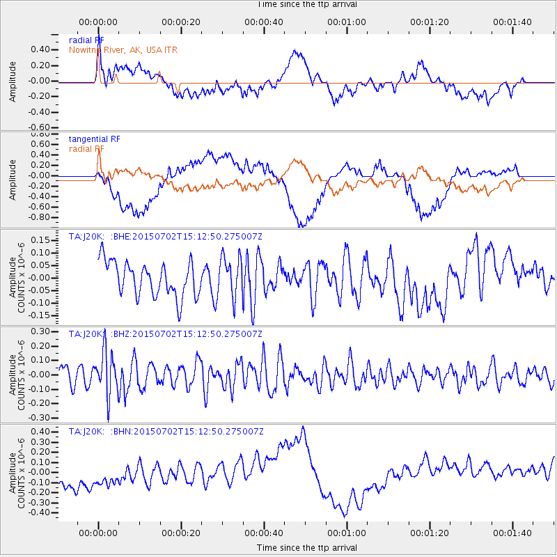
J20K Nowitna River, AK, USA - Earthquake Result Viewer
*The percent match for this event was below the threshold and hence no stack was calculated.
| Earthquake location: |
Eastern New Guinea Reg., P.N.G. |
| Earthquake latitude/longitude: |
-5.9/147.4 |
| Earthquake time(UTC): |
2015/07/02 (183) 15:01:10 GMT |
| Earthquake Depth: |
90 km |
| Earthquake Magnitude: |
5.4 MW |
| Earthquake Catalog/Contributor: |
ISC/ISC |
|
| Network: |
TA USArray Transportable Network (new EarthScope stations) |
| Station: |
J20K Nowitna River, AK, USA |
| Lat/Lon: |
64.18 N/154.15 W |
| Elevation: |
314 m |
|
| Distance: |
82.2 deg |
| Az: |
22.139 deg |
| Baz: |
238.858 deg |
| Ray Param: |
$rayparam |
*The percent match for this event was below the threshold and hence was not used in the summary stack. |
|
| Radial Match: |
39.856438 % |
| Radial Bump: |
400 |
| Transverse Match: |
47.950626 % |
| Transverse Bump: |
400 |
| SOD ConfigId: |
7422571 |
| Insert Time: |
2019-04-19 14:15:34.821 +0000 |
| GWidth: |
2.5 |
| Max Bumps: |
400 |
| Tol: |
0.001 |
|
Signal To Noise
| Channel | StoN | STA | LTA |
| TA:J20K: :BHZ:20150702T15:12:50.275007Z | 2.5421643 | 1.5401298E-7 | 6.058341E-8 |
| TA:J20K: :BHN:20150702T15:12:50.275007Z | 1.3206301 | 1.8385984E-7 | 1.392213E-7 |
| TA:J20K: :BHE:20150702T15:12:50.275007Z | 1.1685388 | 7.963344E-8 | 6.814788E-8 |
| Arrivals |
| Ps | |
| PpPs | |
| PsPs/PpSs | |


