You are here: Home > Network List > US - United States National Seismic Network Stations List
> Station HAWA Hanford, Washington, USA > Earthquake Result Viewer
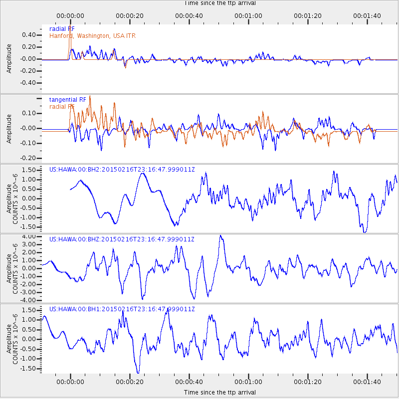
HAWA Hanford, Washington, USA - Earthquake Result Viewer
*The percent match for this event was below the threshold and hence no stack was calculated.
| Earthquake location: |
Near East Coast Of Honshu, Japan |
| Earthquake latitude/longitude: |
39.8/142.9 |
| Earthquake time(UTC): |
2015/02/16 (047) 23:06:27 GMT |
| Earthquake Depth: |
23 km |
| Earthquake Magnitude: |
6.7 MWW, 6.9 MI |
| Earthquake Catalog/Contributor: |
NEIC PDE/NEIC COMCAT |
|
| Network: |
US United States National Seismic Network |
| Station: |
HAWA Hanford, Washington, USA |
| Lat/Lon: |
46.39 N/119.53 W |
| Elevation: |
364 m |
|
| Distance: |
67.0 deg |
| Az: |
48.173 deg |
| Baz: |
303.999 deg |
| Ray Param: |
$rayparam |
*The percent match for this event was below the threshold and hence was not used in the summary stack. |
|
| Radial Match: |
72.032684 % |
| Radial Bump: |
400 |
| Transverse Match: |
39.29767 % |
| Transverse Bump: |
384 |
| SOD ConfigId: |
872571 |
| Insert Time: |
2015-03-02 23:19:17.677 +0000 |
| GWidth: |
2.5 |
| Max Bumps: |
400 |
| Tol: |
0.001 |
|
Signal To Noise
| Channel | StoN | STA | LTA |
| US:HAWA:00:BHZ:20150216T23:16:47.999011Z | 2.6189332 | 1.2595365E-6 | 4.8093494E-7 |
| US:HAWA:00:BH1:20150216T23:16:47.999011Z | 0.38566086 | 2.9725032E-7 | 7.707558E-7 |
| US:HAWA:00:BH2:20150216T23:16:47.999011Z | 0.8607367 | 6.5367726E-7 | 7.594392E-7 |
| Arrivals |
| Ps | |
| PpPs | |
| PsPs/PpSs | |


