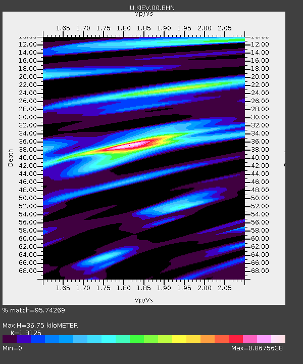
KIEV Kiev, Ukraine - Earthquake Result Viewer

Earthquake location: Talaud Islands, Indonesia
Earthquake latitude/longitude: 3.9/126.4
Earthquake time(UTC): 2009/02/11 (042) 17:34:50 GMT
Earthquake Depth: 22 km
Earthquake Magnitude: 6.6 MB, 7.2 MS, 7.2 MW, 7.1 MW
Earthquake Catalog/Contributor: WHDF/NEIC
Network: IU Global Seismograph Network (GSN - IRIS/USGS)
Station: KIEV Kiev, Ukraine
Lat/Lon: 50.69 N/29.21 E
Elevation: 163 m
Distance: 91.6 deg
Az: 320.858 deg
Baz: 81.999 deg
Ray Param: 0.041584823
Estimated Moho Depth: 36.75 km
Estimated Crust Vp/Vs: 1.81
Assumed Crust Vp: 6.552 km/s
Estimated Crust Vs: 3.615 km/s
Estimated Crust Poisson's Ratio: 0.28
Radial Match: 95.74269 %
Radial Bump: 400
Transverse Match: 90.41267 %
Transverse Bump: 400
SOD ConfigId: 2658
Insert Time: 2010-03-03 15:33:08.963 +0000
GWidth: 2.5
Max Bumps: 400
Tol: 0.001

Signal To Noise

ChannelStoNSTALTA
IU:KIEV:00:BHN:20090211T17:47:24.273022Z9.0199681.5159283E-61.6806361E-7
IU:KIEV:00:BHE:20090211T17:47:24.273022Z1.33940853.1392347E-72.343747E-7
IU:KIEV:00:BHZ:20090211T17:47:24.273022Z2.39319663.8671385E-71.6158883E-7
Arrivals
Ps4.7 SECOND
PpPs15 SECOND
PsPs/PpSs20 SECOND