You are here: Home > Network List > CI - Caltech Regional Seismic Network Stations List
> Station MPP McPhearson Peak > Earthquake Result Viewer
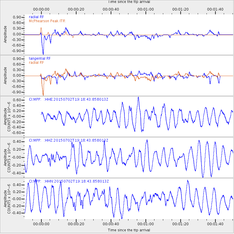
MPP McPhearson Peak - Earthquake Result Viewer
*The percent match for this event was below the threshold and hence no stack was calculated.
| Earthquake location: |
South Of Kermadec Islands |
| Earthquake latitude/longitude: |
-32.1/-177.8 |
| Earthquake time(UTC): |
2015/07/02 (183) 19:06:36 GMT |
| Earthquake Depth: |
24 km |
| Earthquake Magnitude: |
5.2 MW |
| Earthquake Catalog/Contributor: |
ISC/ISC |
|
| Network: |
CI Caltech Regional Seismic Network |
| Station: |
MPP McPhearson Peak |
| Lat/Lon: |
34.89 N/119.81 W |
| Elevation: |
1739 m |
|
| Distance: |
86.1 deg |
| Az: |
44.344 deg |
| Baz: |
226.176 deg |
| Ray Param: |
$rayparam |
*The percent match for this event was below the threshold and hence was not used in the summary stack. |
|
| Radial Match: |
72.47944 % |
| Radial Bump: |
400 |
| Transverse Match: |
49.035515 % |
| Transverse Bump: |
400 |
| SOD ConfigId: |
7422571 |
| Insert Time: |
2019-04-19 14:18:57.522 +0000 |
| GWidth: |
2.5 |
| Max Bumps: |
400 |
| Tol: |
0.001 |
|
Signal To Noise
| Channel | StoN | STA | LTA |
| CI:MPP: :HHZ:20150702T19:18:43.858013Z | 0.5291913 | 7.332303E-8 | 1.3855676E-7 |
| CI:MPP: :HHN:20150702T19:18:43.858013Z | 1.009807 | 2.870354E-7 | 2.842478E-7 |
| CI:MPP: :HHE:20150702T19:18:43.858013Z | 1.6065282 | 1.8539683E-7 | 1.1540217E-7 |
| Arrivals |
| Ps | |
| PpPs | |
| PsPs/PpSs | |


