You are here: Home > Network List > IU - Global Seismograph Network (GSN - IRIS/USGS) Stations List
> Station JOHN Johnston Island, USA > Earthquake Result Viewer
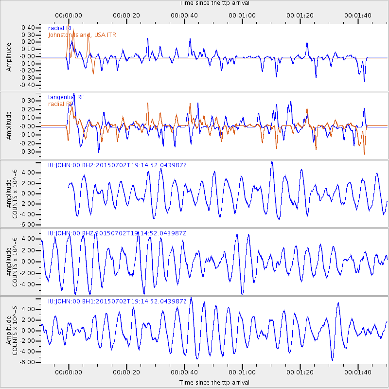
JOHN Johnston Island, USA - Earthquake Result Viewer
*The percent match for this event was below the threshold and hence no stack was calculated.
| Earthquake location: |
South Of Kermadec Islands |
| Earthquake latitude/longitude: |
-32.1/-177.8 |
| Earthquake time(UTC): |
2015/07/02 (183) 19:06:36 GMT |
| Earthquake Depth: |
24 km |
| Earthquake Magnitude: |
5.2 MW |
| Earthquake Catalog/Contributor: |
ISC/ISC |
|
| Network: |
IU Global Seismograph Network (GSN - IRIS/USGS) |
| Station: |
JOHN Johnston Island, USA |
| Lat/Lon: |
16.73 N/169.53 W |
| Elevation: |
2.0 m |
|
| Distance: |
49.2 deg |
| Az: |
10.537 deg |
| Baz: |
189.32 deg |
| Ray Param: |
$rayparam |
*The percent match for this event was below the threshold and hence was not used in the summary stack. |
|
| Radial Match: |
64.23213 % |
| Radial Bump: |
400 |
| Transverse Match: |
60.38627 % |
| Transverse Bump: |
400 |
| SOD ConfigId: |
7422571 |
| Insert Time: |
2019-04-19 14:19:41.604 +0000 |
| GWidth: |
2.5 |
| Max Bumps: |
400 |
| Tol: |
0.001 |
|
Signal To Noise
| Channel | StoN | STA | LTA |
| IU:JOHN:00:BHZ:20150702T19:14:52.043987Z | 1.7573159 | 3.6142508E-6 | 2.0566881E-6 |
| IU:JOHN:00:BH1:20150702T19:14:52.043987Z | 0.5532016 | 8.5345715E-7 | 1.5427597E-6 |
| IU:JOHN:00:BH2:20150702T19:14:52.043987Z | 1.769946 | 3.3112017E-6 | 1.8707925E-6 |
| Arrivals |
| Ps | |
| PpPs | |
| PsPs/PpSs | |


