You are here: Home > Network List > IW - Intermountain West Stations List
> Station DLMT Dillon, Montana, USA > Earthquake Result Viewer
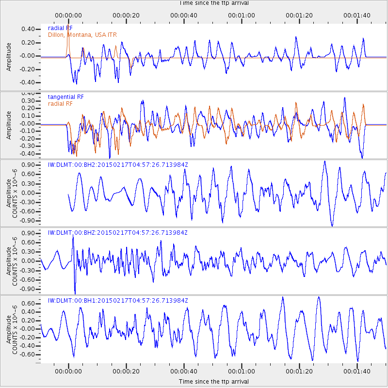
DLMT Dillon, Montana, USA - Earthquake Result Viewer
*The percent match for this event was below the threshold and hence no stack was calculated.
| Earthquake location: |
Near East Coast Of Honshu, Japan |
| Earthquake latitude/longitude: |
40.2/141.9 |
| Earthquake time(UTC): |
2015/02/17 (048) 04:46:38 GMT |
| Earthquake Depth: |
40 km |
| Earthquake Magnitude: |
5.8 MB |
| Earthquake Catalog/Contributor: |
NEIC PDE/NEIC COMCAT |
|
| Network: |
IW Intermountain West |
| Station: |
DLMT Dillon, Montana, USA |
| Lat/Lon: |
45.36 N/112.60 W |
| Elevation: |
1569 m |
|
| Distance: |
71.9 deg |
| Az: |
45.63 deg |
| Baz: |
309.026 deg |
| Ray Param: |
$rayparam |
*The percent match for this event was below the threshold and hence was not used in the summary stack. |
|
| Radial Match: |
57.487965 % |
| Radial Bump: |
386 |
| Transverse Match: |
58.111713 % |
| Transverse Bump: |
400 |
| SOD ConfigId: |
872571 |
| Insert Time: |
2015-03-03 05:01:36.901 +0000 |
| GWidth: |
2.5 |
| Max Bumps: |
400 |
| Tol: |
0.001 |
|
Signal To Noise
| Channel | StoN | STA | LTA |
| IW:DLMT:00:BHZ:20150217T04:57:26.713984Z | 2.8044786 | 3.6933994E-7 | 1.3169647E-7 |
| IW:DLMT:00:BH1:20150217T04:57:26.713984Z | 1.3405566 | 3.4433828E-7 | 2.568622E-7 |
| IW:DLMT:00:BH2:20150217T04:57:26.713984Z | 0.8330716 | 2.4848802E-7 | 2.9827933E-7 |
| Arrivals |
| Ps | |
| PpPs | |
| PsPs/PpSs | |


