You are here: Home > Network List > TA - USArray Transportable Network (new EarthScope stations) Stations List
> Station T25A Trinidad, CO, USA > Earthquake Result Viewer
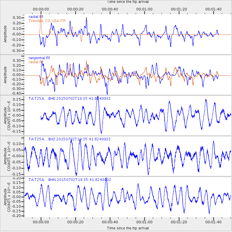
T25A Trinidad, CO, USA - Earthquake Result Viewer
*The percent match for this event was below the threshold and hence no stack was calculated.
| Earthquake location: |
South Of Kermadec Islands |
| Earthquake latitude/longitude: |
-32.1/-178.1 |
| Earthquake time(UTC): |
2015/07/02 (183) 19:22:42 GMT |
| Earthquake Depth: |
24 km |
| Earthquake Magnitude: |
4.9 MW |
| Earthquake Catalog/Contributor: |
ISC/ISC |
|
| Network: |
TA USArray Transportable Network (new EarthScope stations) |
| Station: |
T25A Trinidad, CO, USA |
| Lat/Lon: |
37.14 N/104.41 W |
| Elevation: |
2017 m |
|
| Distance: |
97.3 deg |
| Az: |
50.633 deg |
| Baz: |
235.168 deg |
| Ray Param: |
$rayparam |
*The percent match for this event was below the threshold and hence was not used in the summary stack. |
|
| Radial Match: |
43.248173 % |
| Radial Bump: |
365 |
| Transverse Match: |
54.263145 % |
| Transverse Bump: |
400 |
| SOD ConfigId: |
7422571 |
| Insert Time: |
2019-04-19 14:25:41.407 +0000 |
| GWidth: |
2.5 |
| Max Bumps: |
400 |
| Tol: |
0.001 |
|
Signal To Noise
| Channel | StoN | STA | LTA |
| TA:T25A: :BHZ:20150702T19:35:41.824993Z | 0.8170015 | 4.8167788E-8 | 5.895679E-8 |
| TA:T25A: :BHN:20150702T19:35:41.824993Z | 1.4124877 | 8.8069676E-8 | 6.235075E-8 |
| TA:T25A: :BHE:20150702T19:35:41.824993Z | 2.1984143 | 9.806518E-8 | 4.4607233E-8 |
| Arrivals |
| Ps | |
| PpPs | |
| PsPs/PpSs | |


