You are here: Home > Network List > US - United States National Seismic Network Stations List
> Station MSO Missoula, Montana, USA > Earthquake Result Viewer
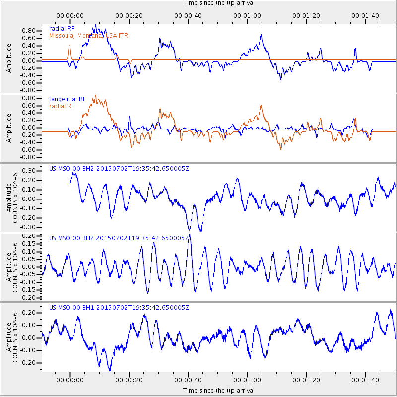
MSO Missoula, Montana, USA - Earthquake Result Viewer
*The percent match for this event was below the threshold and hence no stack was calculated.
| Earthquake location: |
South Of Kermadec Islands |
| Earthquake latitude/longitude: |
-32.1/-178.1 |
| Earthquake time(UTC): |
2015/07/02 (183) 19:22:42 GMT |
| Earthquake Depth: |
24 km |
| Earthquake Magnitude: |
4.9 MW |
| Earthquake Catalog/Contributor: |
ISC/ISC |
|
| Network: |
US United States National Seismic Network |
| Station: |
MSO Missoula, Montana, USA |
| Lat/Lon: |
46.83 N/113.94 W |
| Elevation: |
1264 m |
|
| Distance: |
97.5 deg |
| Az: |
38.542 deg |
| Baz: |
230.35 deg |
| Ray Param: |
$rayparam |
*The percent match for this event was below the threshold and hence was not used in the summary stack. |
|
| Radial Match: |
31.925226 % |
| Radial Bump: |
400 |
| Transverse Match: |
60.45628 % |
| Transverse Bump: |
396 |
| SOD ConfigId: |
7422571 |
| Insert Time: |
2019-04-19 14:26:01.664 +0000 |
| GWidth: |
2.5 |
| Max Bumps: |
400 |
| Tol: |
0.001 |
|
Signal To Noise
| Channel | StoN | STA | LTA |
| US:MSO:00:BHZ:20150702T19:35:42.650005Z | 0.90191776 | 5.2149833E-8 | 5.7821055E-8 |
| US:MSO:00:BH1:20150702T19:35:42.650005Z | 0.63754946 | 6.297115E-8 | 9.87706E-8 |
| US:MSO:00:BH2:20150702T19:35:42.650005Z | 0.4483986 | 4.946271E-8 | 1.1030969E-7 |
| Arrivals |
| Ps | |
| PpPs | |
| PsPs/PpSs | |


