You are here: Home > Network List > US - United States National Seismic Network Stations List
> Station HDIL Hopedale, Illinois, USA > Earthquake Result Viewer
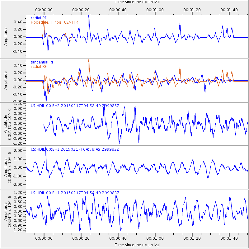
HDIL Hopedale, Illinois, USA - Earthquake Result Viewer
*The percent match for this event was below the threshold and hence no stack was calculated.
| Earthquake location: |
Near East Coast Of Honshu, Japan |
| Earthquake latitude/longitude: |
40.2/141.9 |
| Earthquake time(UTC): |
2015/02/17 (048) 04:46:38 GMT |
| Earthquake Depth: |
40 km |
| Earthquake Magnitude: |
5.8 MB |
| Earthquake Catalog/Contributor: |
NEIC PDE/NEIC COMCAT |
|
| Network: |
US United States National Seismic Network |
| Station: |
HDIL Hopedale, Illinois, USA |
| Lat/Lon: |
40.56 N/89.29 W |
| Elevation: |
219 m |
|
| Distance: |
87.1 deg |
| Az: |
36.471 deg |
| Baz: |
323.292 deg |
| Ray Param: |
$rayparam |
*The percent match for this event was below the threshold and hence was not used in the summary stack. |
|
| Radial Match: |
59.681587 % |
| Radial Bump: |
400 |
| Transverse Match: |
80.168335 % |
| Transverse Bump: |
400 |
| SOD ConfigId: |
872571 |
| Insert Time: |
2015-03-03 05:04:17.399 +0000 |
| GWidth: |
2.5 |
| Max Bumps: |
400 |
| Tol: |
0.001 |
|
Signal To Noise
| Channel | StoN | STA | LTA |
| US:HDIL:00:BHZ:20150217T04:58:49.299983Z | 2.0858846 | 8.0679297E-7 | 3.8678695E-7 |
| US:HDIL:00:BH1:20150217T04:58:49.299983Z | 1.3259203 | 5.1032356E-7 | 3.848825E-7 |
| US:HDIL:00:BH2:20150217T04:58:49.299983Z | 1.7758198 | 4.825531E-7 | 2.7173542E-7 |
| Arrivals |
| Ps | |
| PpPs | |
| PsPs/PpSs | |


