You are here: Home > Network List > US - United States National Seismic Network Stations List
> Station WMOK Wichita Mountains, Oklahoma, USA > Earthquake Result Viewer
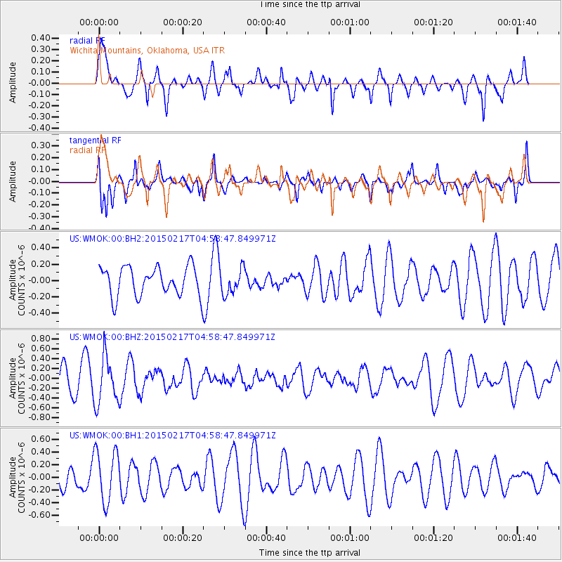
WMOK Wichita Mountains, Oklahoma, USA - Earthquake Result Viewer
*The percent match for this event was below the threshold and hence no stack was calculated.
| Earthquake location: |
Near East Coast Of Honshu, Japan |
| Earthquake latitude/longitude: |
40.2/141.9 |
| Earthquake time(UTC): |
2015/02/17 (048) 04:46:38 GMT |
| Earthquake Depth: |
40 km |
| Earthquake Magnitude: |
5.8 MB |
| Earthquake Catalog/Contributor: |
NEIC PDE/NEIC COMCAT |
|
| Network: |
US United States National Seismic Network |
| Station: |
WMOK Wichita Mountains, Oklahoma, USA |
| Lat/Lon: |
34.74 N/98.78 W |
| Elevation: |
486 m |
|
| Distance: |
86.8 deg |
| Az: |
45.981 deg |
| Baz: |
318.01 deg |
| Ray Param: |
$rayparam |
*The percent match for this event was below the threshold and hence was not used in the summary stack. |
|
| Radial Match: |
55.06517 % |
| Radial Bump: |
400 |
| Transverse Match: |
68.02256 % |
| Transverse Bump: |
400 |
| SOD ConfigId: |
872571 |
| Insert Time: |
2015-03-03 05:04:58.862 +0000 |
| GWidth: |
2.5 |
| Max Bumps: |
400 |
| Tol: |
0.001 |
|
Signal To Noise
| Channel | StoN | STA | LTA |
| US:WMOK:00:BHZ:20150217T04:58:47.849971Z | 1.8080287 | 4.735083E-7 | 2.6189204E-7 |
| US:WMOK:00:BH1:20150217T04:58:47.849971Z | 2.1473906 | 4.1015286E-7 | 1.9100058E-7 |
| US:WMOK:00:BH2:20150217T04:58:47.849971Z | 0.87030447 | 1.5508176E-7 | 1.7819254E-7 |
| Arrivals |
| Ps | |
| PpPs | |
| PsPs/PpSs | |


