KIEV Kiev, Ukraine - Earthquake Result Viewer
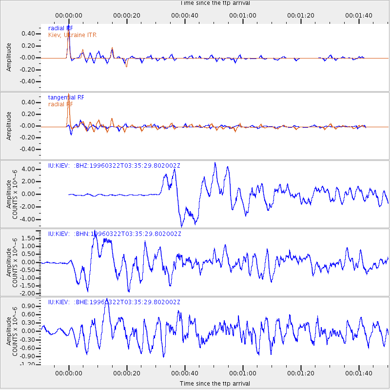
Earthquake location: Rat Islands, Aleutian Islands
Earthquake latitude/longitude: 51.2/178.7
Earthquake time(UTC): 1996/03/22 (082) 03:24:20 GMT
Earthquake Depth: 20 km
Earthquake Magnitude: 5.7 MB, 6.6 MS, 6.8 UNKNOWN, 6.6 ML
Earthquake Catalog/Contributor: WHDF/NEIC
Network: IU Global Seismograph Network (GSN - IRIS/USGS)
Station: KIEV Kiev, Ukraine
Lat/Lon: 50.69 N/29.21 E
Elevation: 163 m
Distance: 75.2 deg
Az: 340.488 deg
Baz: 19.284 deg
Ray Param: 0.05180819
Estimated Moho Depth: 36.5 km
Estimated Crust Vp/Vs: 1.77
Assumed Crust Vp: 6.552 km/s
Estimated Crust Vs: 3.692 km/s
Estimated Crust Poisson's Ratio: 0.27
Radial Match: 95.44326 %
Radial Bump: 347
Transverse Match: 83.32543 %
Transverse Bump: 400
SOD ConfigId: 6273
Insert Time: 2010-03-03 15:37:07.881 +0000
GWidth: 2.5
Max Bumps: 400
Tol: 0.001

Signal To Noise

ChannelStoNSTALTA
IU:KIEV: :BHN:19960322T03:35:29.802002Z9.1472426.8072495E-77.44186E-8
IU:KIEV: :BHE:19960322T03:35:29.802002Z1.85574722.3309873E-71.256091E-7
IU:KIEV: :BHZ:19960322T03:35:29.802002Z20.2250581.6587436E-68.201428E-8
Arrivals
Ps4.5 SECOND
PpPs15 SECOND
PsPs/PpSs19 SECOND