KIEV Kiev, Ukraine - Earthquake Result Viewer
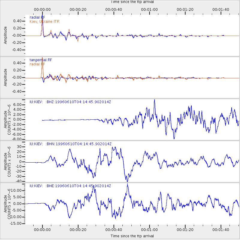
Earthquake location: Andreanof Islands, Aleutian Is.
Earthquake latitude/longitude: 51.6/-177.6
Earthquake time(UTC): 1996/06/10 (162) 04:03:35 GMT
Earthquake Depth: 33 km
Earthquake Magnitude: 6.6 MB, 7.6 MS, 7.9 UNKNOWN, 7.4 MS
Earthquake Catalog/Contributor: WHDF/NEIC
Network: IU Global Seismograph Network (GSN - IRIS/USGS)
Station: KIEV Kiev, Ukraine
Lat/Lon: 50.69 N/29.21 E
Elevation: 163 m
Distance: 75.6 deg
Az: 342.754 deg
Baz: 16.916 deg
Ray Param: 0.0515113
Estimated Moho Depth: 35.75 km
Estimated Crust Vp/Vs: 1.82
Assumed Crust Vp: 6.552 km/s
Estimated Crust Vs: 3.605 km/s
Estimated Crust Poisson's Ratio: 0.28
Radial Match: 98.321526 %
Radial Bump: 355
Transverse Match: 95.632515 %
Transverse Bump: 400
SOD ConfigId: 4480
Insert Time: 2010-03-03 15:40:25.321 +0000
GWidth: 2.5
Max Bumps: 400
Tol: 0.001

Signal To Noise

ChannelStoNSTALTA
IU:KIEV: :BHN:19960610T04:14:45.902014Z14.3179425.3225313E-63.717386E-7
IU:KIEV: :BHE:19960610T04:14:45.902014Z10.76697352.0484604E-61.9025406E-7
IU:KIEV: :BHZ:19960610T04:14:45.902014Z4.93984753.7160817E-77.522665E-8
Arrivals
Ps4.6 SECOND
PpPs15 SECOND
PsPs/PpSs19 SECOND