You are here: Home > Network List > UW - Pacific Northwest Regional Seismic Network Stations List
> Station MRBL Marblemount, WA, USA > Earthquake Result Viewer
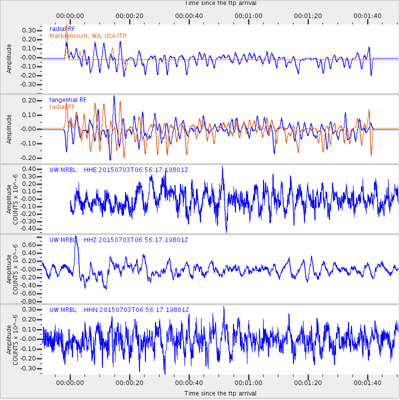
MRBL Marblemount, WA, USA - Earthquake Result Viewer
*The percent match for this event was below the threshold and hence no stack was calculated.
| Earthquake location: |
Leyte, Philippines |
| Earthquake latitude/longitude: |
10.2/125.9 |
| Earthquake time(UTC): |
2015/07/03 (184) 06:43:23 GMT |
| Earthquake Depth: |
50 km |
| Earthquake Magnitude: |
6.0 MB |
| Earthquake Catalog/Contributor: |
NEIC PDE/NEIC ALERT |
|
| Network: |
UW Pacific Northwest Regional Seismic Network |
| Station: |
MRBL Marblemount, WA, USA |
| Lat/Lon: |
48.52 N/121.48 W |
| Elevation: |
75 m |
|
| Distance: |
96.9 deg |
| Az: |
38.202 deg |
| Baz: |
293.687 deg |
| Ray Param: |
$rayparam |
*The percent match for this event was below the threshold and hence was not used in the summary stack. |
|
| Radial Match: |
53.971527 % |
| Radial Bump: |
400 |
| Transverse Match: |
61.136124 % |
| Transverse Bump: |
400 |
| SOD ConfigId: |
7422571 |
| Insert Time: |
2019-04-19 15:00:21.656 +0000 |
| GWidth: |
2.5 |
| Max Bumps: |
400 |
| Tol: |
0.001 |
|
Signal To Noise
| Channel | StoN | STA | LTA |
| UW:MRBL: :HHZ:20150703T06:56:17.19801Z | 2.3456206 | 3.461992E-7 | 1.4759385E-7 |
| UW:MRBL: :HHN:20150703T06:56:17.19801Z | 1.2245845 | 9.398496E-8 | 7.674845E-8 |
| UW:MRBL: :HHE:20150703T06:56:17.19801Z | 1.769866 | 1.7692263E-7 | 9.996385E-8 |
| Arrivals |
| Ps | |
| PpPs | |
| PsPs/PpSs | |


