You are here: Home > Network List > US - United States National Seismic Network Stations List
> Station ELK Elko, Nevada, USA > Earthquake Result Viewer
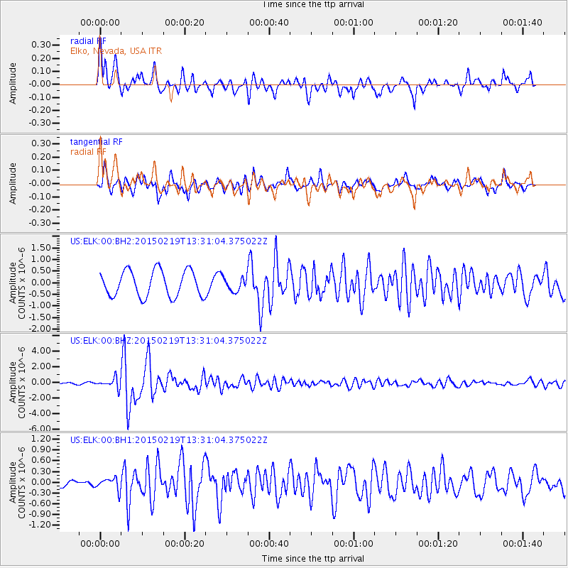
ELK Elko, Nevada, USA - Earthquake Result Viewer
*The percent match for this event was below the threshold and hence no stack was calculated.
| Earthquake location: |
Vanuatu Islands |
| Earthquake latitude/longitude: |
-16.4/168.1 |
| Earthquake time(UTC): |
2015/02/19 (050) 13:18:32 GMT |
| Earthquake Depth: |
10 km |
| Earthquake Magnitude: |
6.5 MWP |
| Earthquake Catalog/Contributor: |
NEIC PDE/NEIC COMCAT |
|
| Network: |
US United States National Seismic Network |
| Station: |
ELK Elko, Nevada, USA |
| Lat/Lon: |
40.74 N/115.24 W |
| Elevation: |
2210 m |
|
| Distance: |
90.8 deg |
| Az: |
47.68 deg |
| Baz: |
249.079 deg |
| Ray Param: |
$rayparam |
*The percent match for this event was below the threshold and hence was not used in the summary stack. |
|
| Radial Match: |
65.8097 % |
| Radial Bump: |
400 |
| Transverse Match: |
85.14753 % |
| Transverse Bump: |
400 |
| SOD ConfigId: |
872571 |
| Insert Time: |
2015-03-05 13:37:34.566 +0000 |
| GWidth: |
2.5 |
| Max Bumps: |
400 |
| Tol: |
0.001 |
|
Signal To Noise
| Channel | StoN | STA | LTA |
| US:ELK:00:BHZ:20150219T13:31:04.375022Z | 1.8549749 | 6.285738E-7 | 3.3885837E-7 |
| US:ELK:00:BH1:20150219T13:31:04.375022Z | 0.8706 | 1.6795232E-7 | 1.9291559E-7 |
| US:ELK:00:BH2:20150219T13:31:04.375022Z | 0.5122485 | 2.8366657E-7 | 5.5376745E-7 |
| Arrivals |
| Ps | |
| PpPs | |
| PsPs/PpSs | |


