You are here: Home > Network List > TA - USArray Transportable Network (new EarthScope stations) Stations List
> Station J62A Henniker, NH, USA > Earthquake Result Viewer
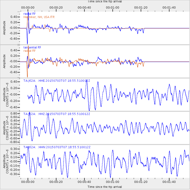
J62A Henniker, NH, USA - Earthquake Result Viewer
*The percent match for this event was below the threshold and hence no stack was calculated.
| Earthquake location: |
Kuril Islands |
| Earthquake latitude/longitude: |
45.1/148.1 |
| Earthquake time(UTC): |
2015/07/03 (184) 07:07:08 GMT |
| Earthquake Depth: |
162 km |
| Earthquake Magnitude: |
4.4 mb |
| Earthquake Catalog/Contributor: |
ISC/ISC |
|
| Network: |
TA USArray Transportable Network (new EarthScope stations) |
| Station: |
J62A Henniker, NH, USA |
| Lat/Lon: |
43.23 N/71.81 W |
| Elevation: |
266 m |
|
| Distance: |
85.2 deg |
| Az: |
28.078 deg |
| Baz: |
332.842 deg |
| Ray Param: |
$rayparam |
*The percent match for this event was below the threshold and hence was not used in the summary stack. |
|
| Radial Match: |
61.36997 % |
| Radial Bump: |
400 |
| Transverse Match: |
54.909153 % |
| Transverse Bump: |
400 |
| SOD ConfigId: |
7422571 |
| Insert Time: |
2019-04-19 15:08:46.746 +0000 |
| GWidth: |
2.5 |
| Max Bumps: |
400 |
| Tol: |
0.001 |
|
Signal To Noise
| Channel | StoN | STA | LTA |
| TA:J62A: :HHZ:20150703T07:18:55.510012Z | 2.4359791 | 4.88302E-7 | 2.004541E-7 |
| TA:J62A: :HHN:20150703T07:18:55.510012Z | 1.2889204 | 1.8591636E-7 | 1.4424192E-7 |
| TA:J62A: :HHE:20150703T07:18:55.510012Z | 0.7913526 | 1.06784455E-7 | 1.3493916E-7 |
| Arrivals |
| Ps | |
| PpPs | |
| PsPs/PpSs | |


