You are here: Home > Network List > TA - USArray Transportable Network (new EarthScope stations) Stations List
> Station J04D Umpqua National Forest, Toketee, OR, USA > Earthquake Result Viewer
J04D Umpqua National Forest, Toketee, OR, USA - Earthquake Result Viewer
*The percent match for this event was below the threshold and hence no stack was calculated.
| Earthquake location: |
South Of Kermadec Islands |
| Earthquake latitude/longitude: |
-32.1/-177.9 |
| Earthquake time(UTC): |
2015/07/04 (185) 17:28:25 GMT |
| Earthquake Depth: |
24 km |
| Earthquake Magnitude: |
5.2 MW |
| Earthquake Catalog/Contributor: |
ISC/ISC |
|
| Network: |
TA USArray Transportable Network (new EarthScope stations) |
| Station: |
J04D Umpqua National Forest, Toketee, OR, USA |
| Lat/Lon: |
43.24 N/122.11 W |
| Elevation: |
1948 m |
|
| Distance: |
90.7 deg |
| Az: |
37.205 deg |
| Baz: |
224.612 deg |
| Ray Param: |
$rayparam |
*The percent match for this event was below the threshold and hence was not used in the summary stack. |
|
| Radial Match: |
67.39658 % |
| Radial Bump: |
400 |
| Transverse Match: |
58.46001 % |
| Transverse Bump: |
400 |
| SOD ConfigId: |
7422571 |
| Insert Time: |
2019-04-19 15:14:58.621 +0000 |
| GWidth: |
2.5 |
| Max Bumps: |
400 |
| Tol: |
0.001 |
|
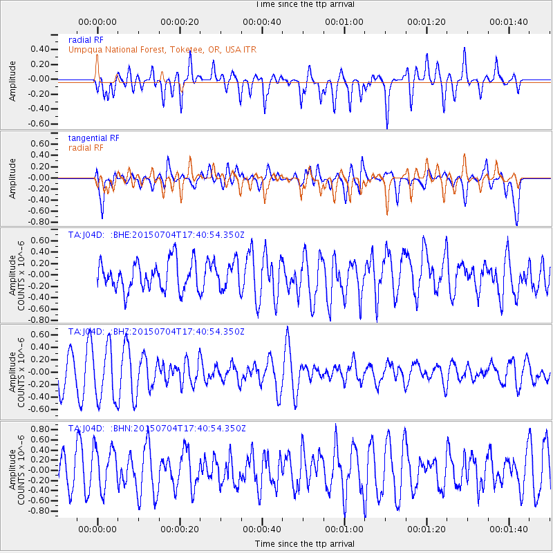
Signal To Noise
| Channel | StoN | STA | LTA |
| TA:J04D: :BHZ:20150704T17:40:54.350Z | 1.9254082 | 4.3562054E-7 | 2.262484E-7 |
| TA:J04D: :BHN:20150704T17:40:54.350Z | 1.5857055 | 4.308851E-7 | 2.7173087E-7 |
| TA:J04D: :BHE:20150704T17:40:54.350Z | 0.9436358 | 2.3560202E-7 | 2.496747E-7 |
| Arrivals |
| Ps | |
| PpPs | |
| PsPs/PpSs | |


