You are here: Home > Network List > GS - US Geological Survey Networks Stations List
> Station DEC05 Decatur Surface Seismic Site, Decatur, IL, USA > Earthquake Result Viewer
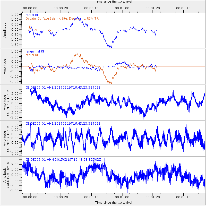
DEC05 Decatur Surface Seismic Site, Decatur, IL, USA - Earthquake Result Viewer
*The percent match for this event was below the threshold and hence no stack was calculated.
| Earthquake location: |
Near East Coast Of Kamchatka |
| Earthquake latitude/longitude: |
52.8/159.0 |
| Earthquake time(UTC): |
2015/02/19 (050) 16:32:48 GMT |
| Earthquake Depth: |
88 km |
| Earthquake Magnitude: |
5.7 MB |
| Earthquake Catalog/Contributor: |
NEIC PDE/NEIC COMCAT |
|
| Network: |
GS US Geological Survey Networks |
| Station: |
DEC05 Decatur Surface Seismic Site, Decatur, IL, USA |
| Lat/Lon: |
39.87 N/88.87 W |
| Elevation: |
216 m |
|
| Distance: |
70.6 deg |
| Az: |
49.069 deg |
| Baz: |
323.456 deg |
| Ray Param: |
$rayparam |
*The percent match for this event was below the threshold and hence was not used in the summary stack. |
|
| Radial Match: |
27.155811 % |
| Radial Bump: |
400 |
| Transverse Match: |
45.91837 % |
| Transverse Bump: |
400 |
| SOD ConfigId: |
872571 |
| Insert Time: |
2015-03-05 16:48:27.388 +0000 |
| GWidth: |
2.5 |
| Max Bumps: |
400 |
| Tol: |
0.001 |
|
Signal To Noise
| Channel | StoN | STA | LTA |
| GS:DEC05:01:HHZ:20150219T16:43:23.32502Z | 1.6363289 | 6.8499486E-7 | 4.1861685E-7 |
| GS:DEC05:01:HHN:20150219T16:43:23.32502Z | 1.0302343 | 1.7968391E-6 | 1.7441072E-6 |
| GS:DEC05:01:HHE:20150219T16:43:23.32502Z | 0.7330558 | 1.0844705E-6 | 1.4793833E-6 |
| Arrivals |
| Ps | |
| PpPs | |
| PsPs/PpSs | |


