You are here: Home > Network List > GS - US Geological Survey Networks Stations List
> Station KAN11 Stewart Ranch, Harper County, KS, USA > Earthquake Result Viewer
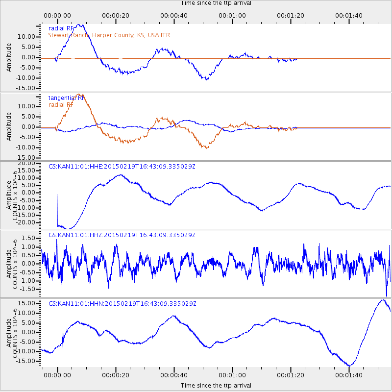
KAN11 Stewart Ranch, Harper County, KS, USA - Earthquake Result Viewer
*The percent match for this event was below the threshold and hence no stack was calculated.
| Earthquake location: |
Near East Coast Of Kamchatka |
| Earthquake latitude/longitude: |
52.8/159.0 |
| Earthquake time(UTC): |
2015/02/19 (050) 16:32:48 GMT |
| Earthquake Depth: |
88 km |
| Earthquake Magnitude: |
5.7 MB |
| Earthquake Catalog/Contributor: |
NEIC PDE/NEIC COMCAT |
|
| Network: |
GS US Geological Survey Networks |
| Station: |
KAN11 Stewart Ranch, Harper County, KS, USA |
| Lat/Lon: |
37.21 N/97.91 W |
| Elevation: |
410 m |
|
| Distance: |
68.4 deg |
| Az: |
56.781 deg |
| Baz: |
320.539 deg |
| Ray Param: |
$rayparam |
*The percent match for this event was below the threshold and hence was not used in the summary stack. |
|
| Radial Match: |
36.860577 % |
| Radial Bump: |
400 |
| Transverse Match: |
19.048794 % |
| Transverse Bump: |
400 |
| SOD ConfigId: |
872571 |
| Insert Time: |
2015-03-05 16:48:40.191 +0000 |
| GWidth: |
2.5 |
| Max Bumps: |
400 |
| Tol: |
0.001 |
|
Signal To Noise
| Channel | StoN | STA | LTA |
| GS:KAN11:01:HHZ:20150219T16:43:09.335029Z | 0.9489071 | 5.8424115E-7 | 6.15699E-7 |
| GS:KAN11:01:HHN:20150219T16:43:09.335029Z | 0.94602656 | 9.6381145E-6 | 1.0187996E-5 |
| GS:KAN11:01:HHE:20150219T16:43:09.335029Z | 0.26181358 | 3.6151916E-6 | 1.3808266E-5 |
| Arrivals |
| Ps | |
| PpPs | |
| PsPs/PpSs | |


