KIEV Kiev, Ukraine - Earthquake Result Viewer
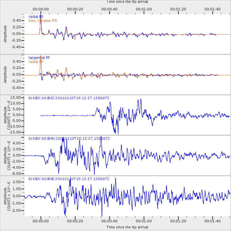
Earthquake location: Kodiak Island Region, Alaska
Earthquake latitude/longitude: 57.1/-153.2
Earthquake time(UTC): 2001/01/10 (010) 16:02:44 GMT
Earthquake Depth: 33 km
Earthquake Magnitude: 6.2 MB, 6.8 MS, 7.1 MW, 6.8 ML
Earthquake Catalog/Contributor: WHDF/NEIC
Network: IU Global Seismograph Network (GSN - IRIS/USGS)
Station: KIEV Kiev, Ukraine
Lat/Lon: 50.69 N/29.21 E
Elevation: 163 m
Distance: 72.6 deg
Az: 358.388 deg
Baz: 1.384 deg
Ray Param: 0.053523112
Estimated Moho Depth: 35.0 km
Estimated Crust Vp/Vs: 1.88
Assumed Crust Vp: 6.552 km/s
Estimated Crust Vs: 3.495 km/s
Estimated Crust Poisson's Ratio: 0.30
Radial Match: 98.34028 %
Radial Bump: 400
Transverse Match: 95.36948 %
Transverse Bump: 400
SOD ConfigId: 3744
Insert Time: 2010-03-03 15:44:04.051 +0000
GWidth: 2.5
Max Bumps: 400
Tol: 0.001

Signal To Noise

ChannelStoNSTALTA
IU:KIEV:00:BHN:20010110T16:13:37.138997Z16.1910171.2889037E-67.96061E-8
IU:KIEV:00:BHE:20010110T16:13:37.138997Z2.83435232.365845E-78.347039E-8
IU:KIEV:00:BHZ:20010110T16:13:37.138997Z26.8468822.953034E-61.0999541E-7
Arrivals
Ps4.8 SECOND
PpPs15 SECOND
PsPs/PpSs20 SECOND