You are here: Home > Network List > UW - Pacific Northwest Regional Seismic Network Stations List
> Station MRBL Marblemount, WA, USA > Earthquake Result Viewer
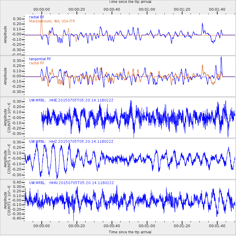
MRBL Marblemount, WA, USA - Earthquake Result Viewer
*The percent match for this event was below the threshold and hence no stack was calculated.
| Earthquake location: |
Southeast Of Loyalty Islands |
| Earthquake latitude/longitude: |
-22.4/171.8 |
| Earthquake time(UTC): |
2015/07/05 (186) 05:07:46 GMT |
| Earthquake Depth: |
100 km |
| Earthquake Magnitude: |
5.2 MW |
| Earthquake Catalog/Contributor: |
ISC/ISC |
|
| Network: |
UW Pacific Northwest Regional Seismic Network |
| Station: |
MRBL Marblemount, WA, USA |
| Lat/Lon: |
48.52 N/121.48 W |
| Elevation: |
75 m |
|
| Distance: |
92.3 deg |
| Az: |
37.692 deg |
| Baz: |
238.346 deg |
| Ray Param: |
$rayparam |
*The percent match for this event was below the threshold and hence was not used in the summary stack. |
|
| Radial Match: |
52.610638 % |
| Radial Bump: |
400 |
| Transverse Match: |
50.655308 % |
| Transverse Bump: |
400 |
| SOD ConfigId: |
7422571 |
| Insert Time: |
2019-04-19 15:30:02.909 +0000 |
| GWidth: |
2.5 |
| Max Bumps: |
400 |
| Tol: |
0.001 |
|
Signal To Noise
| Channel | StoN | STA | LTA |
| UW:MRBL: :HHZ:20150705T05:20:14.118022Z | 2.4393291 | 2.0496024E-7 | 8.40232E-8 |
| UW:MRBL: :HHN:20150705T05:20:14.118022Z | 0.7835584 | 8.697153E-8 | 1.1099559E-7 |
| UW:MRBL: :HHE:20150705T05:20:14.118022Z | 1.158638 | 1.07368244E-7 | 9.2667634E-8 |
| Arrivals |
| Ps | |
| PpPs | |
| PsPs/PpSs | |


