You are here: Home > Network List > CI - Caltech Regional Seismic Network Stations List
> Station MPP McPhearson Peak > Earthquake Result Viewer
MPP McPhearson Peak - Earthquake Result Viewer
*The percent match for this event was below the threshold and hence no stack was calculated.
| Earthquake location: |
Tonga Islands |
| Earthquake latitude/longitude: |
-20.8/-174.5 |
| Earthquake time(UTC): |
2015/07/06 (187) 12:24:00 GMT |
| Earthquake Depth: |
1.0 km |
| Earthquake Magnitude: |
6.2 MO |
| Earthquake Catalog/Contributor: |
NEIC PDE/NEIC ALERT |
|
| Network: |
CI Caltech Regional Seismic Network |
| Station: |
MPP McPhearson Peak |
| Lat/Lon: |
34.89 N/119.81 W |
| Elevation: |
1739 m |
|
| Distance: |
75.9 deg |
| Az: |
43.749 deg |
| Baz: |
231.915 deg |
| Ray Param: |
$rayparam |
*The percent match for this event was below the threshold and hence was not used in the summary stack. |
|
| Radial Match: |
76.28466 % |
| Radial Bump: |
400 |
| Transverse Match: |
66.38052 % |
| Transverse Bump: |
400 |
| SOD ConfigId: |
7422571 |
| Insert Time: |
2019-04-19 15:45:46.790 +0000 |
| GWidth: |
2.5 |
| Max Bumps: |
400 |
| Tol: |
0.001 |
|
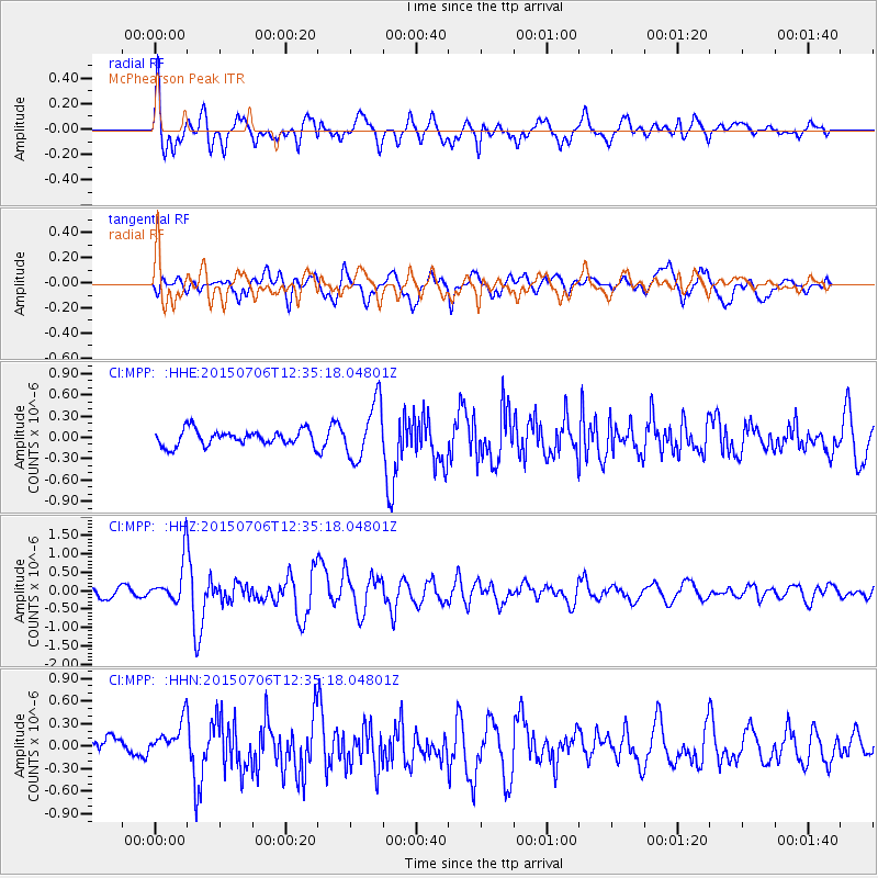
Signal To Noise
| Channel | StoN | STA | LTA |
| CI:MPP: :HHZ:20150706T12:35:18.04801Z | 3.5876327 | 5.987625E-7 | 1.6689626E-7 |
| CI:MPP: :HHN:20150706T12:35:18.04801Z | 1.3091644 | 2.2509657E-7 | 1.7193912E-7 |
| CI:MPP: :HHE:20150706T12:35:18.04801Z | 3.4981837 | 3.7322877E-7 | 1.0669216E-7 |
| Arrivals |
| Ps | |
| PpPs | |
| PsPs/PpSs | |


