You are here: Home > Network List > CI - Caltech Regional Seismic Network Stations List
> Station SMM Simmler, CA, USA > Earthquake Result Viewer
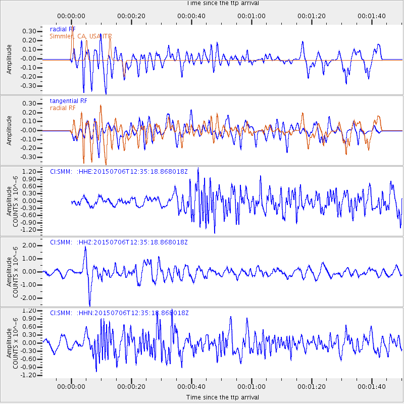
SMM Simmler, CA, USA - Earthquake Result Viewer
*The percent match for this event was below the threshold and hence no stack was calculated.
| Earthquake location: |
Tonga Islands |
| Earthquake latitude/longitude: |
-20.8/-174.5 |
| Earthquake time(UTC): |
2015/07/06 (187) 12:24:00 GMT |
| Earthquake Depth: |
1.0 km |
| Earthquake Magnitude: |
6.2 MO |
| Earthquake Catalog/Contributor: |
NEIC PDE/NEIC ALERT |
|
| Network: |
CI Caltech Regional Seismic Network |
| Station: |
SMM Simmler, CA, USA |
| Lat/Lon: |
35.31 N/120.00 W |
| Elevation: |
599 m |
|
| Distance: |
76.0 deg |
| Az: |
43.31 deg |
| Baz: |
231.704 deg |
| Ray Param: |
$rayparam |
*The percent match for this event was below the threshold and hence was not used in the summary stack. |
|
| Radial Match: |
63.352978 % |
| Radial Bump: |
400 |
| Transverse Match: |
57.34231 % |
| Transverse Bump: |
400 |
| SOD ConfigId: |
7422571 |
| Insert Time: |
2019-04-19 15:45:59.296 +0000 |
| GWidth: |
2.5 |
| Max Bumps: |
400 |
| Tol: |
0.001 |
|
Signal To Noise
| Channel | StoN | STA | LTA |
| CI:SMM: :HHZ:20150706T12:35:18.868018Z | 4.7954135 | 6.249586E-7 | 1.3032424E-7 |
| CI:SMM: :HHN:20150706T12:35:18.868018Z | 1.1968747 | 1.8510887E-7 | 1.546602E-7 |
| CI:SMM: :HHE:20150706T12:35:18.868018Z | 1.4994206 | 2.0128618E-7 | 1.3424264E-7 |
| Arrivals |
| Ps | |
| PpPs | |
| PsPs/PpSs | |


