You are here: Home > Network List > TA - USArray Transportable Network (new EarthScope stations) Stations List
> Station MDND Maddock, ND, USA > Earthquake Result Viewer
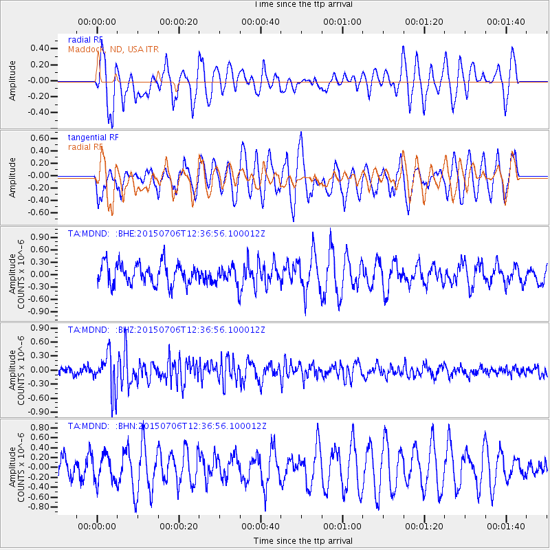
MDND Maddock, ND, USA - Earthquake Result Viewer
*The percent match for this event was below the threshold and hence no stack was calculated.
| Earthquake location: |
Tonga Islands |
| Earthquake latitude/longitude: |
-20.8/-174.5 |
| Earthquake time(UTC): |
2015/07/06 (187) 12:24:00 GMT |
| Earthquake Depth: |
1.0 km |
| Earthquake Magnitude: |
6.2 MO |
| Earthquake Catalog/Contributor: |
NEIC PDE/NEIC ALERT |
|
| Network: |
TA USArray Transportable Network (new EarthScope stations) |
| Station: |
MDND Maddock, ND, USA |
| Lat/Lon: |
47.85 N/99.60 W |
| Elevation: |
479 m |
|
| Distance: |
95.5 deg |
| Az: |
40.788 deg |
| Baz: |
245.161 deg |
| Ray Param: |
$rayparam |
*The percent match for this event was below the threshold and hence was not used in the summary stack. |
|
| Radial Match: |
69.08257 % |
| Radial Bump: |
400 |
| Transverse Match: |
66.77142 % |
| Transverse Bump: |
400 |
| SOD ConfigId: |
7422571 |
| Insert Time: |
2019-04-19 15:49:56.113 +0000 |
| GWidth: |
2.5 |
| Max Bumps: |
400 |
| Tol: |
0.001 |
|
Signal To Noise
| Channel | StoN | STA | LTA |
| TA:MDND: :BHZ:20150706T12:36:56.100012Z | 4.2012806 | 4.1513266E-7 | 9.8810986E-8 |
| TA:MDND: :BHN:20150706T12:36:56.100012Z | 0.9919785 | 2.7642108E-7 | 2.786563E-7 |
| TA:MDND: :BHE:20150706T12:36:56.100012Z | 0.7049465 | 1.8135158E-7 | 2.572558E-7 |
| Arrivals |
| Ps | |
| PpPs | |
| PsPs/PpSs | |


