You are here: Home > Network List > UW - Pacific Northwest Regional Seismic Network Stations List
> Station PASS Maple Falls, WA, USA > Earthquake Result Viewer
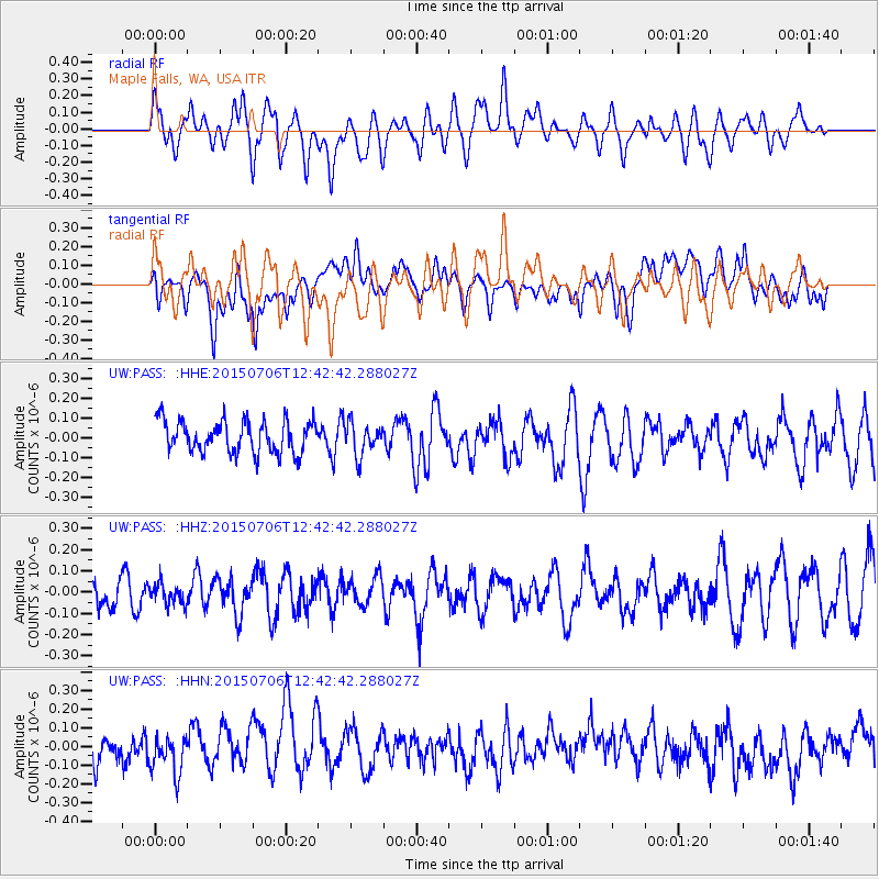
PASS Maple Falls, WA, USA - Earthquake Result Viewer
*The percent match for this event was below the threshold and hence no stack was calculated.
| Earthquake location: |
Tonga Islands |
| Earthquake latitude/longitude: |
-20.7/-174.5 |
| Earthquake time(UTC): |
2015/07/06 (187) 12:30:51 GMT |
| Earthquake Depth: |
56 km |
| Earthquake Magnitude: |
4.9 mb |
| Earthquake Catalog/Contributor: |
ISC/ISC |
|
| Network: |
UW Pacific Northwest Regional Seismic Network |
| Station: |
PASS Maple Falls, WA, USA |
| Lat/Lon: |
49.00 N/122.09 W |
| Elevation: |
174 m |
|
| Distance: |
83.6 deg |
| Az: |
31.692 deg |
| Baz: |
228.309 deg |
| Ray Param: |
$rayparam |
*The percent match for this event was below the threshold and hence was not used in the summary stack. |
|
| Radial Match: |
50.84474 % |
| Radial Bump: |
400 |
| Transverse Match: |
40.5513 % |
| Transverse Bump: |
400 |
| SOD ConfigId: |
7422571 |
| Insert Time: |
2019-04-19 15:58:30.648 +0000 |
| GWidth: |
2.5 |
| Max Bumps: |
400 |
| Tol: |
0.001 |
|
Signal To Noise
| Channel | StoN | STA | LTA |
| UW:PASS: :HHZ:20150706T12:42:42.288027Z | 0.6177441 | 4.732386E-8 | 7.660755E-8 |
| UW:PASS: :HHN:20150706T12:42:42.288027Z | 1.2893575 | 1.0050716E-7 | 7.795135E-8 |
| UW:PASS: :HHE:20150706T12:42:42.288027Z | 0.99527484 | 8.0667824E-8 | 8.10508E-8 |
| Arrivals |
| Ps | |
| PpPs | |
| PsPs/PpSs | |


