
ULN Ulaanbaatar, Mongolia - Earthquake Result Viewer
| ||||||||||||||||||
| ||||||||||||||||||
| ||||||||||||||||||
|
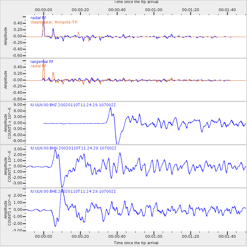
Signal To Noise
| Channel | StoN | STA | LTA |
| IU:ULN:00:BHN:20020110T11:24:29.107002Z | 1.8576529 | 1.7219243E-7 | 9.269354E-8 |
| IU:ULN:00:BHE:20020110T11:24:29.107002Z | 1.2688551 | 1.09994865E-7 | 8.6688274E-8 |
| IU:ULN:00:BHZ:20020110T11:24:29.107002Z | 7.0499115 | 4.802921E-7 | 6.81274E-8 |
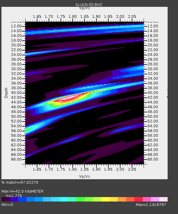
| Arrivals | |
| Ps | 5.2 SECOND |
| PpPs | 17 SECOND |
| PsPs/PpSs | 22 SECOND |

