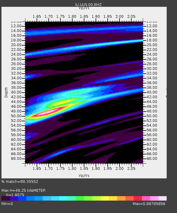
ULN Ulaanbaatar, Mongolia - Earthquake Result Viewer
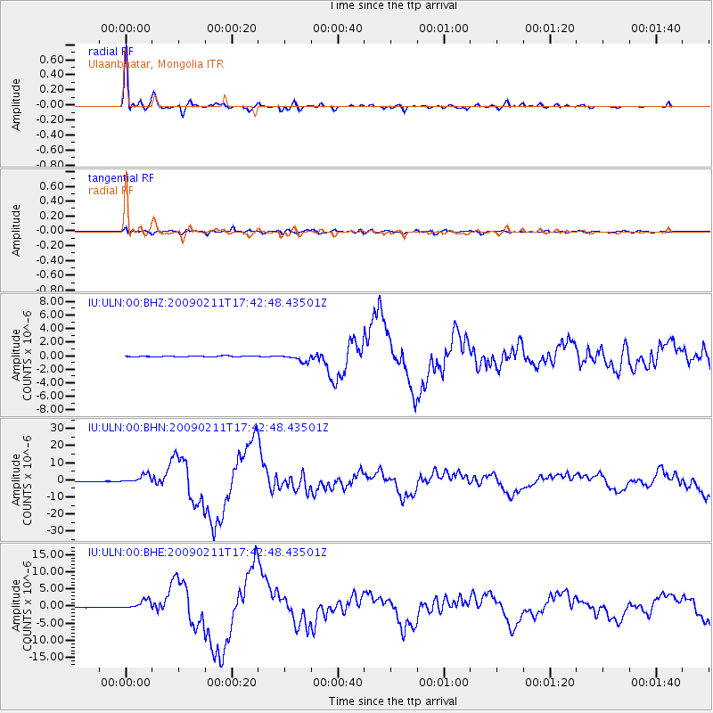
Earthquake location: Talaud Islands, Indonesia
Earthquake latitude/longitude: 3.9/126.4
Earthquake time(UTC): 2009/02/11 (042) 17:34:50 GMT
Earthquake Depth: 22 km
Earthquake Magnitude: 6.6 MB, 7.2 MS, 7.2 MW, 7.1 MW
Earthquake Catalog/Contributor: WHDF/NEIC
Network: IU Global Seismograph Network (GSN - IRIS/USGS)
Station: ULN Ulaanbaatar, Mongolia
Lat/Lon: 47.87 N/107.05 E
Elevation: 1610 m
Distance: 46.9 deg
Az: 342.205 deg
Baz: 153.074 deg
Ray Param: 0.07033462
Estimated Moho Depth: 48.25 km
Estimated Crust Vp/Vs: 1.69
Assumed Crust Vp: 6.642 km/s
Estimated Crust Vs: 3.936 km/s
Estimated Crust Poisson's Ratio: 0.23
Radial Match: 98.35552 %
Radial Bump: 322
Transverse Match: 87.579895 %
Transverse Bump: 400
SOD ConfigId: 2658
Insert Time: 2010-03-03 15:52:30.743 +0000
GWidth: 2.5
Max Bumps: 400
Tol: 0.001

Signal To Noise

ChannelStoNSTALTA
IU:ULN:00:BHN:20090211T17:42:48.43501Z22.4314842.561254E-61.14181205E-7
IU:ULN:00:BHE:20090211T17:42:48.43501Z19.8718531.3688538E-66.888405E-8
IU:ULN:00:BHZ:20090211T17:42:48.43501Z7.38753035.517883E-77.469184E-8
Arrivals
Ps5.4 SECOND
PpPs18 SECOND
PsPs/PpSs24 SECOND