
ULN Ulaanbaatar, Mongolia - Earthquake Result Viewer
| ||||||||||||||||||
| ||||||||||||||||||
| ||||||||||||||||||
|
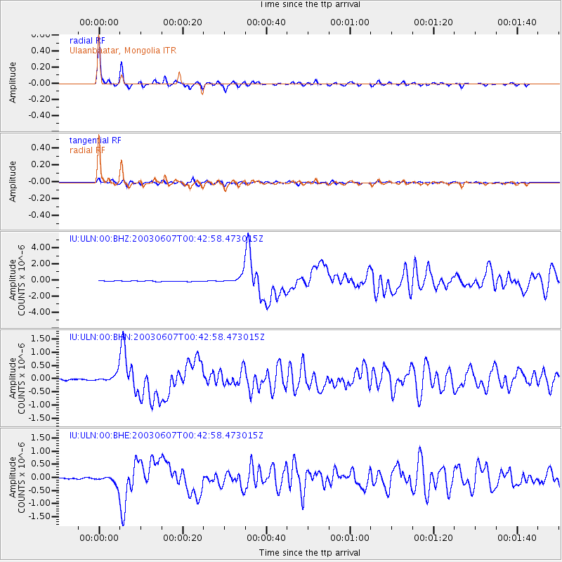
Signal To Noise
| Channel | StoN | STA | LTA |
| IU:ULN:00:BHN:20030607T00:42:58.473015Z | 8.72366 | 1.8271412E-7 | 2.0944661E-8 |
| IU:ULN:00:BHE:20030607T00:42:58.473015Z | 8.652003 | 2.0982245E-7 | 2.4251312E-8 |
| IU:ULN:00:BHZ:20030607T00:42:58.473015Z | 15.281552 | 6.327346E-7 | 4.1405123E-8 |
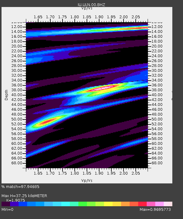
| Arrivals | |
| Ps | 5.3 SECOND |
| PpPs | 16 SECOND |
| PsPs/PpSs | 21 SECOND |

