You are here: Home > Network List > TA - USArray Transportable Network (new EarthScope stations) Stations List
> Station E62A Clayton Lake, ME, USA > Earthquake Result Viewer
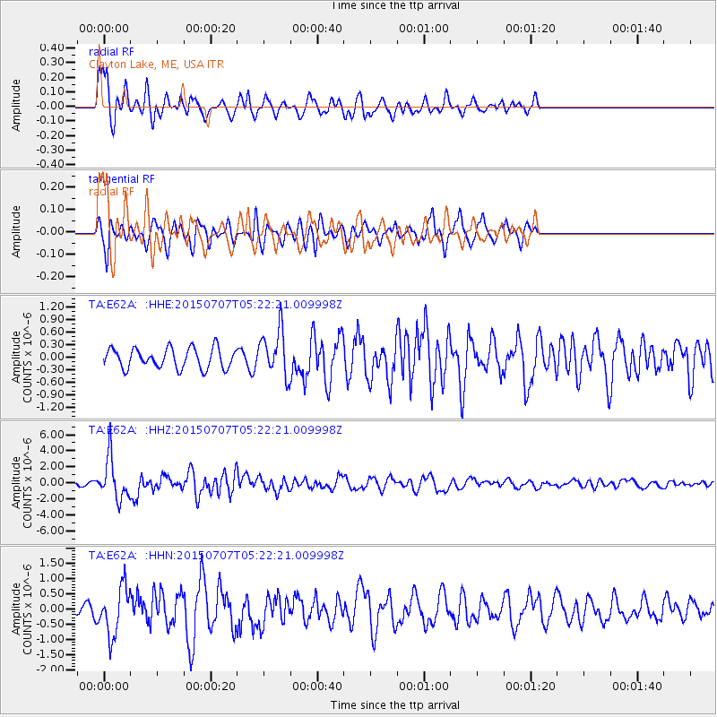
E62A Clayton Lake, ME, USA - Earthquake Result Viewer
*The percent match for this event was below the threshold and hence no stack was calculated.
| Earthquake location: |
Kuril Islands |
| Earthquake latitude/longitude: |
44.0/147.9 |
| Earthquake time(UTC): |
2015/07/07 (188) 05:10:27 GMT |
| Earthquake Depth: |
38 km |
| Earthquake Magnitude: |
6.3 MO |
| Earthquake Catalog/Contributor: |
NEIC PDE/NEIC ALERT |
|
| Network: |
TA USArray Transportable Network (new EarthScope stations) |
| Station: |
E62A Clayton Lake, ME, USA |
| Lat/Lon: |
46.62 N/69.52 W |
| Elevation: |
356 m |
|
| Distance: |
83.9 deg |
| Az: |
24.936 deg |
| Baz: |
333.799 deg |
| Ray Param: |
$rayparam |
*The percent match for this event was below the threshold and hence was not used in the summary stack. |
|
| Radial Match: |
69.221016 % |
| Radial Bump: |
400 |
| Transverse Match: |
77.97469 % |
| Transverse Bump: |
400 |
| SOD ConfigId: |
7422571 |
| Insert Time: |
2019-04-19 16:18:52.916 +0000 |
| GWidth: |
2.5 |
| Max Bumps: |
400 |
| Tol: |
0.001 |
|
Signal To Noise
| Channel | StoN | STA | LTA |
| TA:E62A: :HHZ:20150707T05:22:21.009998Z | 13.416643 | 2.632698E-6 | 1.9622627E-7 |
| TA:E62A: :HHN:20150707T05:22:21.009998Z | 5.6466274 | 7.9739937E-7 | 1.4121693E-7 |
| TA:E62A: :HHE:20150707T05:22:21.009998Z | 2.3006115 | 5.5655454E-7 | 2.4191593E-7 |
| Arrivals |
| Ps | |
| PpPs | |
| PsPs/PpSs | |


