You are here: Home > Network List > TA - USArray Transportable Network (new EarthScope stations) Stations List
> Station L04D Klamath Falls, OR, USA > Earthquake Result Viewer
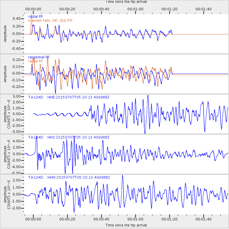
L04D Klamath Falls, OR, USA - Earthquake Result Viewer
*The percent match for this event was below the threshold and hence no stack was calculated.
| Earthquake location: |
Kuril Islands |
| Earthquake latitude/longitude: |
44.0/147.9 |
| Earthquake time(UTC): |
2015/07/07 (188) 05:10:27 GMT |
| Earthquake Depth: |
38 km |
| Earthquake Magnitude: |
6.3 MO |
| Earthquake Catalog/Contributor: |
NEIC PDE/NEIC ALERT |
|
| Network: |
TA USArray Transportable Network (new EarthScope stations) |
| Station: |
L04D Klamath Falls, OR, USA |
| Lat/Lon: |
42.22 N/122.30 W |
| Elevation: |
1437 m |
|
| Distance: |
62.3 deg |
| Az: |
57.071 deg |
| Baz: |
305.351 deg |
| Ray Param: |
$rayparam |
*The percent match for this event was below the threshold and hence was not used in the summary stack. |
|
| Radial Match: |
80.34 % |
| Radial Bump: |
344 |
| Transverse Match: |
82.66136 % |
| Transverse Bump: |
391 |
| SOD ConfigId: |
7422571 |
| Insert Time: |
2019-04-19 16:19:52.495 +0000 |
| GWidth: |
2.5 |
| Max Bumps: |
400 |
| Tol: |
0.001 |
|
Signal To Noise
| Channel | StoN | STA | LTA |
| TA:L04D: :HHZ:20150707T05:20:13.499988Z | 12.109553 | 2.3357052E-6 | 1.928812E-7 |
| TA:L04D: :HHN:20150707T05:20:13.499988Z | 4.4865236 | 5.2082646E-7 | 1.16086866E-7 |
| TA:L04D: :HHE:20150707T05:20:13.499988Z | 3.705029 | 5.7692125E-7 | 1.5571302E-7 |
| Arrivals |
| Ps | |
| PpPs | |
| PsPs/PpSs | |


