You are here: Home > Network List > TA - USArray Transportable Network (new EarthScope stations) Stations List
> Station N02D Trinity Center, CA, USA > Earthquake Result Viewer
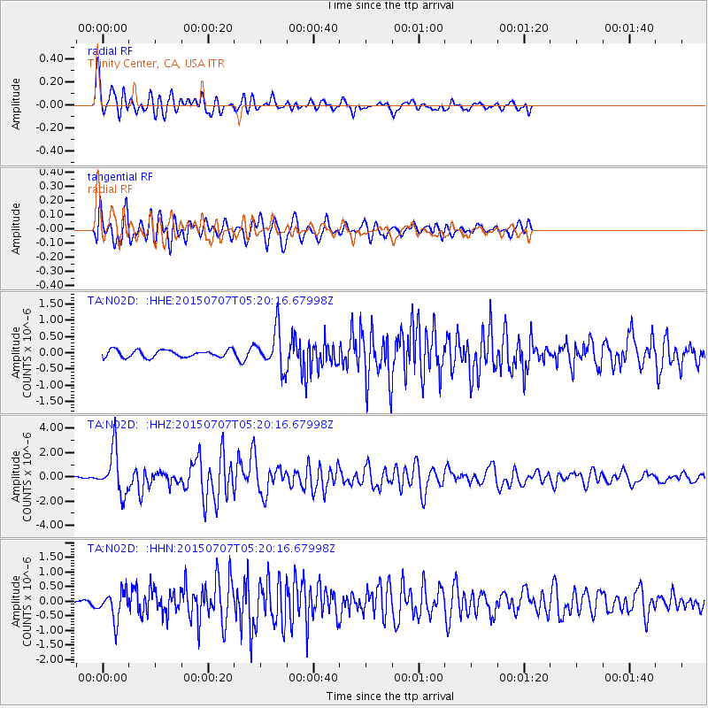
N02D Trinity Center, CA, USA - Earthquake Result Viewer
*The percent match for this event was below the threshold and hence no stack was calculated.
| Earthquake location: |
Kuril Islands |
| Earthquake latitude/longitude: |
44.0/147.9 |
| Earthquake time(UTC): |
2015/07/07 (188) 05:10:27 GMT |
| Earthquake Depth: |
38 km |
| Earthquake Magnitude: |
6.3 MO |
| Earthquake Catalog/Contributor: |
NEIC PDE/NEIC ALERT |
|
| Network: |
TA USArray Transportable Network (new EarthScope stations) |
| Station: |
N02D Trinity Center, CA, USA |
| Lat/Lon: |
40.97 N/122.71 W |
| Elevation: |
937 m |
|
| Distance: |
62.7 deg |
| Az: |
58.408 deg |
| Baz: |
305.704 deg |
| Ray Param: |
$rayparam |
*The percent match for this event was below the threshold and hence was not used in the summary stack. |
|
| Radial Match: |
83.94636 % |
| Radial Bump: |
400 |
| Transverse Match: |
84.39357 % |
| Transverse Bump: |
400 |
| SOD ConfigId: |
7422571 |
| Insert Time: |
2019-04-19 16:20:10.873 +0000 |
| GWidth: |
2.5 |
| Max Bumps: |
400 |
| Tol: |
0.001 |
|
Signal To Noise
| Channel | StoN | STA | LTA |
| TA:N02D: :HHZ:20150707T05:20:16.67998Z | 14.269703 | 1.838488E-6 | 1.2883855E-7 |
| TA:N02D: :HHN:20150707T05:20:16.67998Z | 5.265193 | 4.8592057E-7 | 9.228922E-8 |
| TA:N02D: :HHE:20150707T05:20:16.67998Z | 5.7071853 | 6.21789E-7 | 1.08948456E-7 |
| Arrivals |
| Ps | |
| PpPs | |
| PsPs/PpSs | |


