You are here: Home > Network List > TA - USArray Transportable Network (new EarthScope stations) Stations List
> Station Q61A Milford, DE, USA > Earthquake Result Viewer
Q61A Milford, DE, USA - Earthquake Result Viewer
*The percent match for this event was below the threshold and hence no stack was calculated.
| Earthquake location: |
Kuril Islands |
| Earthquake latitude/longitude: |
44.0/147.9 |
| Earthquake time(UTC): |
2015/07/07 (188) 05:10:27 GMT |
| Earthquake Depth: |
38 km |
| Earthquake Magnitude: |
6.3 MO |
| Earthquake Catalog/Contributor: |
NEIC PDE/NEIC ALERT |
|
| Network: |
TA USArray Transportable Network (new EarthScope stations) |
| Station: |
Q61A Milford, DE, USA |
| Lat/Lon: |
38.88 N/75.33 W |
| Elevation: |
5.0 m |
|
| Distance: |
88.7 deg |
| Az: |
32.347 deg |
| Baz: |
330.342 deg |
| Ray Param: |
$rayparam |
*The percent match for this event was below the threshold and hence was not used in the summary stack. |
|
| Radial Match: |
79.11119 % |
| Radial Bump: |
390 |
| Transverse Match: |
56.985886 % |
| Transverse Bump: |
400 |
| SOD ConfigId: |
7422571 |
| Insert Time: |
2019-04-19 16:20:26.514 +0000 |
| GWidth: |
2.5 |
| Max Bumps: |
400 |
| Tol: |
0.001 |
|
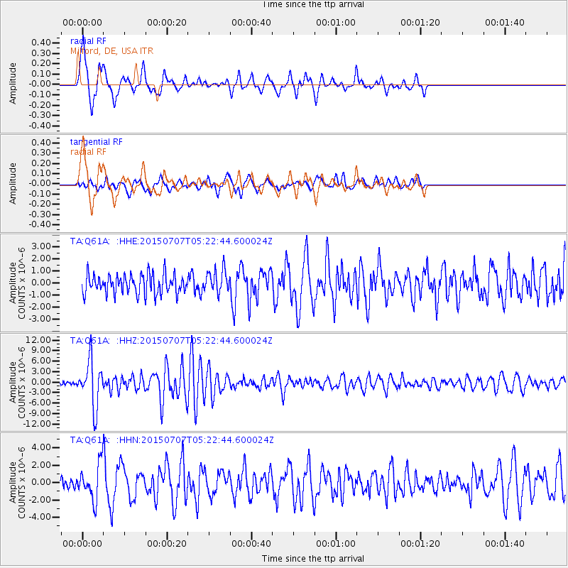
Signal To Noise
| Channel | StoN | STA | LTA |
| TA:Q61A: :HHZ:20150707T05:22:44.600024Z | 12.77568 | 6.6965713E-6 | 5.2416556E-7 |
| TA:Q61A: :HHN:20150707T05:22:44.600024Z | 3.802869 | 2.181772E-6 | 5.737174E-7 |
| TA:Q61A: :HHE:20150707T05:22:44.600024Z | 1.4717519 | 1.1446399E-6 | 7.777397E-7 |
| Arrivals |
| Ps | |
| PpPs | |
| PsPs/PpSs | |


