
ULN Ulaanbaatar, Mongolia - Earthquake Result Viewer
| ||||||||||||||||||
| ||||||||||||||||||
| ||||||||||||||||||
|
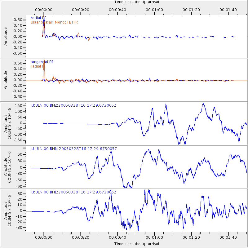
Signal To Noise
| Channel | StoN | STA | LTA |
| IU:ULN:00:BHN:20050328T16:17:29.673005Z | 7.3946633 | 3.039448E-6 | 4.1103263E-7 |
| IU:ULN:00:BHE:20050328T16:17:29.673005Z | 4.98654 | 1.006989E-6 | 2.0194142E-7 |
| IU:ULN:00:BHZ:20050328T16:17:29.673005Z | 5.4097633 | 5.0008175E-6 | 9.24406E-7 |
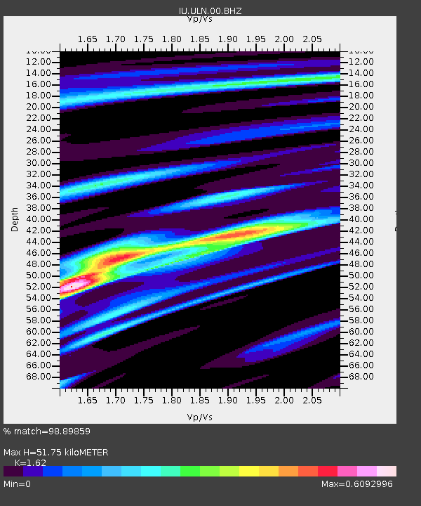
| Arrivals | |
| Ps | 5.2 SECOND |
| PpPs | 19 SECOND |
| PsPs/PpSs | 24 SECOND |

