You are here: Home > Network List > TA - USArray Transportable Network (new EarthScope stations) Stations List
> Station 109C Camp Elliot, Mirimar, CA, USA > Earthquake Result Viewer
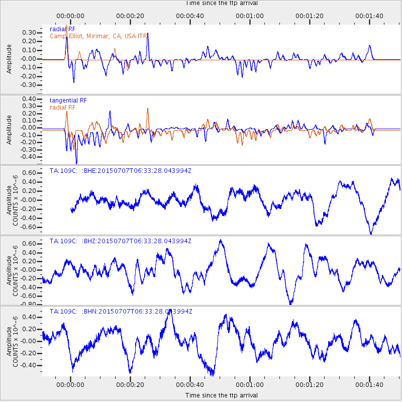
109C Camp Elliot, Mirimar, CA, USA - Earthquake Result Viewer
*The percent match for this event was below the threshold and hence no stack was calculated.
| Earthquake location: |
East Of North Island, N.Z. |
| Earthquake latitude/longitude: |
-35.4/-179.7 |
| Earthquake time(UTC): |
2015/07/07 (188) 06:21:02 GMT |
| Earthquake Depth: |
10 km |
| Earthquake Magnitude: |
5.6 MO |
| Earthquake Catalog/Contributor: |
NEIC PDE/NEIC ALERT |
|
| Network: |
TA USArray Transportable Network (new EarthScope stations) |
| Station: |
109C Camp Elliot, Mirimar, CA, USA |
| Lat/Lon: |
32.89 N/117.11 W |
| Elevation: |
150 m |
|
| Distance: |
89.8 deg |
| Az: |
48.352 deg |
| Baz: |
226.486 deg |
| Ray Param: |
$rayparam |
*The percent match for this event was below the threshold and hence was not used in the summary stack. |
|
| Radial Match: |
72.88971 % |
| Radial Bump: |
400 |
| Transverse Match: |
70.363846 % |
| Transverse Bump: |
400 |
| SOD ConfigId: |
7422571 |
| Insert Time: |
2019-04-19 16:31:21.511 +0000 |
| GWidth: |
2.5 |
| Max Bumps: |
400 |
| Tol: |
0.001 |
|
Signal To Noise
| Channel | StoN | STA | LTA |
| TA:109C: :BHZ:20150707T06:33:28.043994Z | 0.73570335 | 1.3390803E-7 | 1.8201362E-7 |
| TA:109C: :BHN:20150707T06:33:28.043994Z | 2.6936443 | 2.6837517E-7 | 9.963274E-8 |
| TA:109C: :BHE:20150707T06:33:28.043994Z | 0.9105642 | 9.412625E-8 | 1.03371356E-7 |
| Arrivals |
| Ps | |
| PpPs | |
| PsPs/PpSs | |


