You are here: Home > Network List > TA - USArray Transportable Network (new EarthScope stations) Stations List
> Station M54A Oil Creek State Park, Oil City, PA, USA > Earthquake Result Viewer
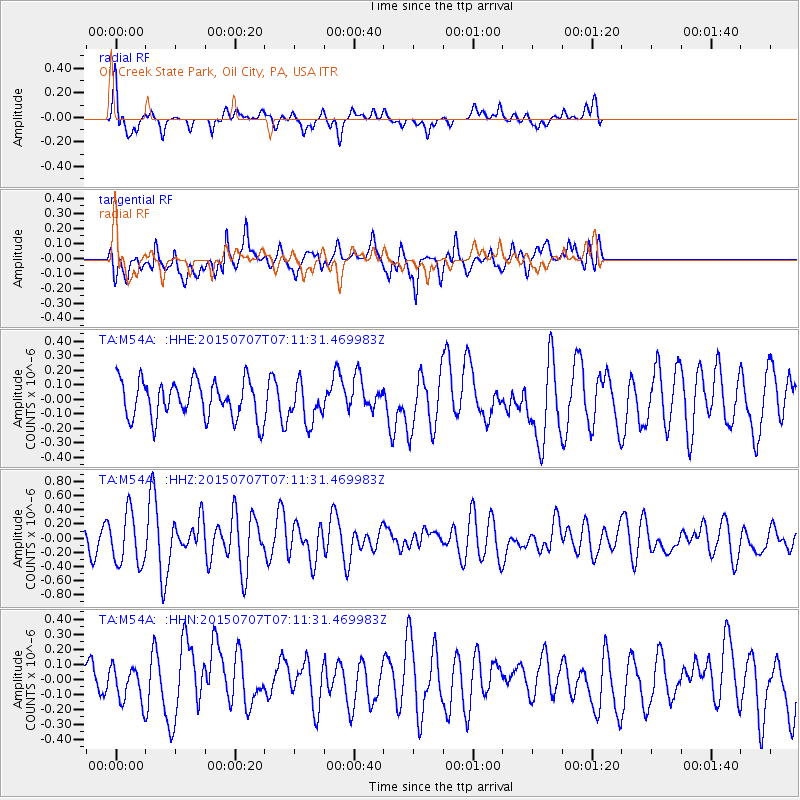
M54A Oil Creek State Park, Oil City, PA, USA - Earthquake Result Viewer
*The percent match for this event was below the threshold and hence no stack was calculated.
| Earthquake location: |
Central East Pacific Rise |
| Earthquake latitude/longitude: |
-13.3/-111.6 |
| Earthquake time(UTC): |
2015/07/07 (188) 07:01:44 GMT |
| Earthquake Depth: |
21 km |
| Earthquake Magnitude: |
5.9 MWW, 5.9 MWC |
| Earthquake Catalog/Contributor: |
NEIC PDE/NEIC COMCAT |
|
| Network: |
TA USArray Transportable Network (new EarthScope stations) |
| Station: |
M54A Oil Creek State Park, Oil City, PA, USA |
| Lat/Lon: |
41.51 N/79.66 W |
| Elevation: |
488 m |
|
| Distance: |
62.0 deg |
| Az: |
26.764 deg |
| Baz: |
215.708 deg |
| Ray Param: |
$rayparam |
*The percent match for this event was below the threshold and hence was not used in the summary stack. |
|
| Radial Match: |
68.45767 % |
| Radial Bump: |
361 |
| Transverse Match: |
61.501575 % |
| Transverse Bump: |
400 |
| SOD ConfigId: |
7422571 |
| Insert Time: |
2019-04-19 16:38:23.135 +0000 |
| GWidth: |
2.5 |
| Max Bumps: |
400 |
| Tol: |
0.001 |
|
Signal To Noise
| Channel | StoN | STA | LTA |
| TA:M54A: :HHZ:20150707T07:11:31.469983Z | 1.9528806 | 3.6657354E-7 | 1.8770915E-7 |
| TA:M54A: :HHN:20150707T07:11:31.469983Z | 0.68371874 | 1.2626236E-7 | 1.8467004E-7 |
| TA:M54A: :HHE:20150707T07:11:31.469983Z | 1.0101833 | 1.2638748E-7 | 1.251134E-7 |
| Arrivals |
| Ps | |
| PpPs | |
| PsPs/PpSs | |


