
ULN Ulaanbaatar, Mongolia - Earthquake Result Viewer
| ||||||||||||||||||
| ||||||||||||||||||
| ||||||||||||||||||
|
Signal To Noise
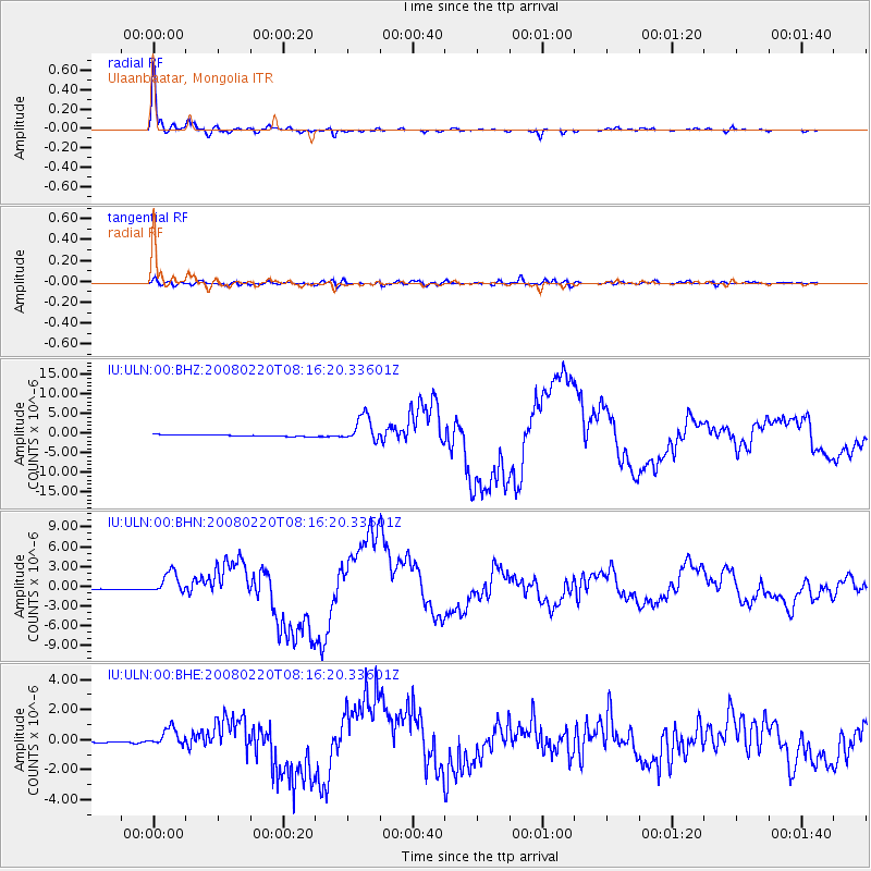
| Channel | StoN | STA | LTA |
| IU:ULN:00:BHN:20080220T08:16:20.33601Z | 11.331908 | 1.6031408E-6 | 1.4147139E-7 |
| IU:ULN:00:BHE:20080220T08:16:20.33601Z | 9.585667 | 5.777058E-7 | 6.026767E-8 |
| IU:ULN:00:BHZ:20080220T08:16:20.33601Z | 17.747698 | 3.3962713E-6 | 1.9136405E-7 |
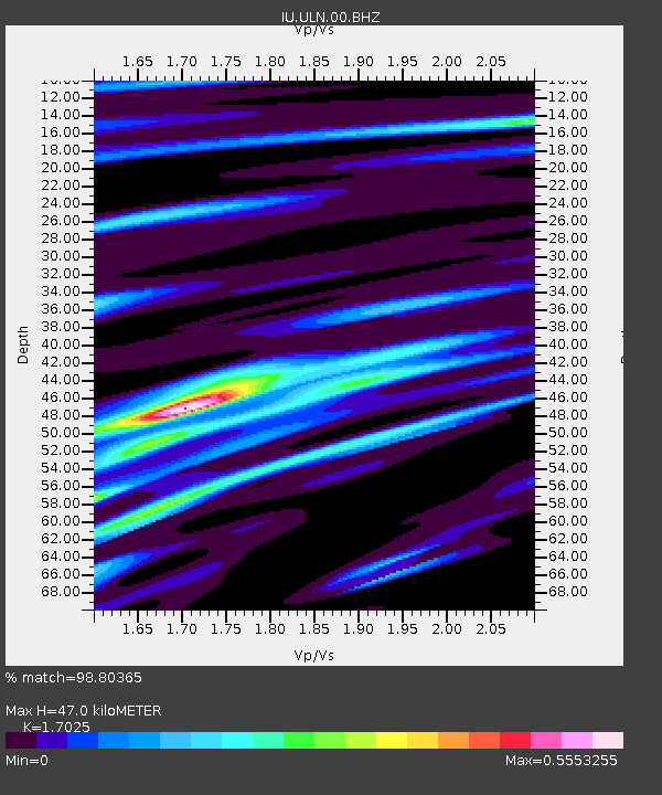
| Arrivals | |
| Ps | 5.3 SECOND |
| PpPs | 18 SECOND |
| PsPs/PpSs | 23 SECOND |

