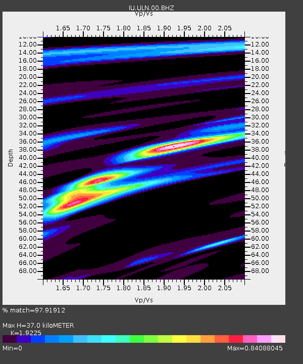
ULN Ulaanbaatar, Mongolia - Earthquake Result Viewer

Earthquake location: Santa Cruz Islands Region
Earthquake latitude/longitude: -11.0/164.5
Earthquake time(UTC): 2008/07/19 (201) 09:27:01 GMT
Earthquake Depth: 11 km
Earthquake Magnitude: 6.1 MB, 6.4 MS, 6.6 MW, 6.6 MW
Earthquake Catalog/Contributor: WHDF/NEIC
Network: IU Global Seismograph Network (GSN - IRIS/USGS)
Station: ULN Ulaanbaatar, Mongolia
Lat/Lon: 47.87 N/107.05 E
Elevation: 1610 m
Distance: 77.6 deg
Az: 324.47 deg
Baz: 122.085 deg
Ray Param: 0.05022477
Estimated Moho Depth: 37.0 km
Estimated Crust Vp/Vs: 1.92
Assumed Crust Vp: 6.642 km/s
Estimated Crust Vs: 3.455 km/s
Estimated Crust Poisson's Ratio: 0.31
Radial Match: 97.91912 %
Radial Bump: 239
Transverse Match: 89.29568 %
Transverse Bump: 400
SOD ConfigId: 2658
Insert Time: 2010-03-03 16:01:02.299 +0000
GWidth: 2.5
Max Bumps: 400
Tol: 0.001

Signal To Noise

ChannelStoNSTALTA
IU:ULN:00:BHN:20080719T09:38:26.035012Z29.9638061.6096689E-65.372044E-8
IU:ULN:00:BHE:20080719T09:38:26.035012Z13.3046413.6610638E-72.7517194E-8
IU:ULN:00:BHZ:20080719T09:38:26.035012Z17.4648324.866397E-72.7863978E-8
Arrivals
Ps5.3 SECOND
PpPs16 SECOND
PsPs/PpSs21 SECOND