You are here: Home > Network List > TA - USArray Transportable Network (new EarthScope stations) Stations List
> Station J20K Nowitna River, AK, USA > Earthquake Result Viewer
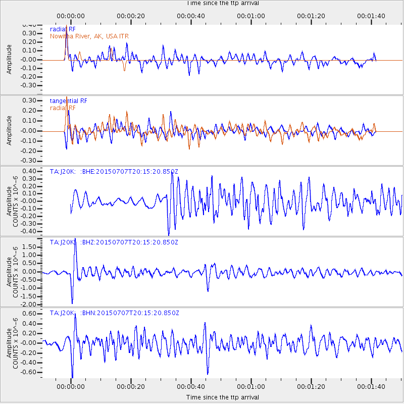
J20K Nowitna River, AK, USA - Earthquake Result Viewer
*The percent match for this event was below the threshold and hence no stack was calculated.
| Earthquake location: |
South Of Fiji Islands |
| Earthquake latitude/longitude: |
-23.1/-177.0 |
| Earthquake time(UTC): |
2015/07/07 (188) 20:03:13 GMT |
| Earthquake Depth: |
120 km |
| Earthquake Magnitude: |
5.8 MO |
| Earthquake Catalog/Contributor: |
NEIC PDE/NEIC ALERT |
|
| Network: |
TA USArray Transportable Network (new EarthScope stations) |
| Station: |
J20K Nowitna River, AK, USA |
| Lat/Lon: |
64.18 N/154.15 W |
| Elevation: |
314 m |
|
| Distance: |
88.8 deg |
| Az: |
9.808 deg |
| Baz: |
200.987 deg |
| Ray Param: |
$rayparam |
*The percent match for this event was below the threshold and hence was not used in the summary stack. |
|
| Radial Match: |
74.881096 % |
| Radial Bump: |
400 |
| Transverse Match: |
70.49579 % |
| Transverse Bump: |
400 |
| SOD ConfigId: |
7422571 |
| Insert Time: |
2019-04-19 17:04:18.416 +0000 |
| GWidth: |
2.5 |
| Max Bumps: |
400 |
| Tol: |
0.001 |
|
Signal To Noise
| Channel | StoN | STA | LTA |
| TA:J20K: :BHZ:20150707T20:15:20.850Z | 15.489773 | 8.672029E-7 | 5.5985517E-8 |
| TA:J20K: :BHN:20150707T20:15:20.850Z | 3.599819 | 2.9028433E-7 | 8.063859E-8 |
| TA:J20K: :BHE:20150707T20:15:20.850Z | 4.726776 | 2.4237136E-7 | 5.1276253E-8 |
| Arrivals |
| Ps | |
| PpPs | |
| PsPs/PpSs | |


