
ULN Ulaanbaatar, Mongolia - Earthquake Result Viewer
| ||||||||||||||||||
| ||||||||||||||||||
| ||||||||||||||||||
|
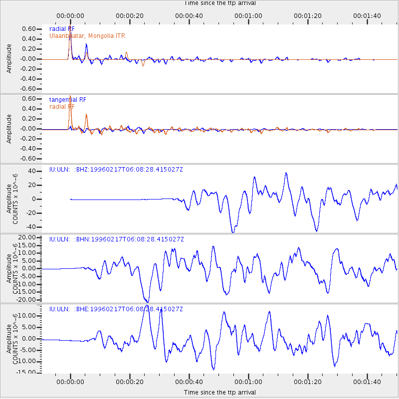
Signal To Noise
| Channel | StoN | STA | LTA |
| IU:ULN: :BHN:19960217T06:08:28.415027Z | 4.711238 | 6.2985E-7 | 1.3369097E-7 |
| IU:ULN: :BHE:19960217T06:08:28.415027Z | 5.251144 | 4.83666E-7 | 9.210678E-8 |
| IU:ULN: :BHZ:19960217T06:08:28.415027Z | 6.6580434 | 1.2659608E-6 | 1.9014007E-7 |
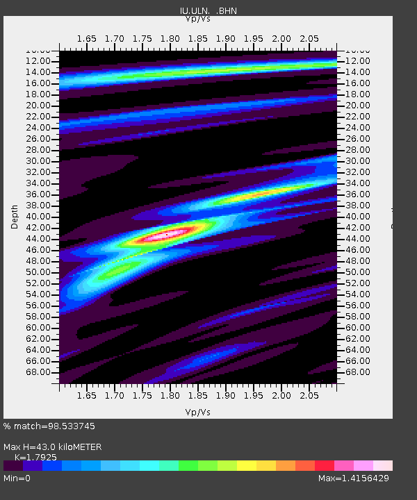
| Arrivals | |
| Ps | 5.4 SECOND |
| PpPs | 17 SECOND |
| PsPs/PpSs | 23 SECOND |

