You are here: Home > Network List > AV - Alaska Volcano Observatory Stations List
> Station SPCR Ckakachatna River, Mount Spurr, Alaska > Earthquake Result Viewer
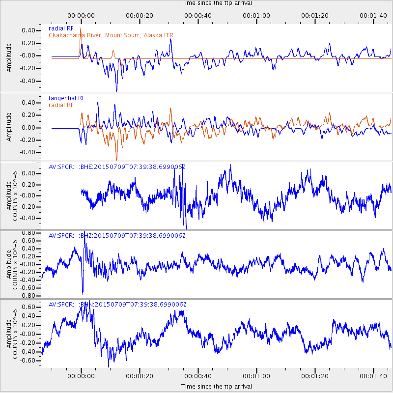
SPCR Ckakachatna River, Mount Spurr, Alaska - Earthquake Result Viewer
*The percent match for this event was below the threshold and hence no stack was calculated.
| Earthquake location: |
Fiji Islands Region |
| Earthquake latitude/longitude: |
-18.7/-177.1 |
| Earthquake time(UTC): |
2015/07/09 (190) 07:28:28 GMT |
| Earthquake Depth: |
352 km |
| Earthquake Magnitude: |
5.5 MW |
| Earthquake Catalog/Contributor: |
ISC/ISC |
|
| Network: |
AV Alaska Volcano Observatory |
| Station: |
SPCR Ckakachatna River, Mount Spurr, Alaska |
| Lat/Lon: |
61.20 N/152.21 W |
| Elevation: |
984 m |
|
| Distance: |
82.1 deg |
| Az: |
11.886 deg |
| Baz: |
203.779 deg |
| Ray Param: |
$rayparam |
*The percent match for this event was below the threshold and hence was not used in the summary stack. |
|
| Radial Match: |
65.155334 % |
| Radial Bump: |
400 |
| Transverse Match: |
69.9097 % |
| Transverse Bump: |
400 |
| SOD ConfigId: |
7422571 |
| Insert Time: |
2019-04-19 17:24:47.893 +0000 |
| GWidth: |
2.5 |
| Max Bumps: |
400 |
| Tol: |
0.001 |
|
Signal To Noise
| Channel | StoN | STA | LTA |
| AV:SPCR: :BHZ:20150709T07:39:38.699006Z | 2.298814 | 3.4094975E-7 | 1.4831551E-7 |
| AV:SPCR: :BHN:20150709T07:39:38.699006Z | 2.802241 | 5.5146825E-7 | 1.9679541E-7 |
| AV:SPCR: :BHE:20150709T07:39:38.699006Z | 1.62073 | 1.9984374E-7 | 1.2330477E-7 |
| Arrivals |
| Ps | |
| PpPs | |
| PsPs/PpSs | |


