You are here: Home > Network List > US - United States National Seismic Network Stations List
> Station AMTX Amarillo, Texas, USA > Earthquake Result Viewer
AMTX Amarillo, Texas, USA - Earthquake Result Viewer
*The percent match for this event was below the threshold and hence no stack was calculated.
| Earthquake location: |
Southeast Of Honshu, Japan |
| Earthquake latitude/longitude: |
31.1/141.9 |
| Earthquake time(UTC): |
2015/02/25 (056) 07:01:01 GMT |
| Earthquake Depth: |
10 km |
| Earthquake Magnitude: |
5.7 MB |
| Earthquake Catalog/Contributor: |
NEIC PDE/NEIC COMCAT |
|
| Network: |
US United States National Seismic Network |
| Station: |
AMTX Amarillo, Texas, USA |
| Lat/Lon: |
34.53 N/101.41 W |
| Elevation: |
1010 m |
|
| Distance: |
91.6 deg |
| Az: |
47.53 deg |
| Baz: |
309.958 deg |
| Ray Param: |
$rayparam |
*The percent match for this event was below the threshold and hence was not used in the summary stack. |
|
| Radial Match: |
52.224228 % |
| Radial Bump: |
400 |
| Transverse Match: |
49.776085 % |
| Transverse Bump: |
400 |
| SOD ConfigId: |
872571 |
| Insert Time: |
2015-03-11 07:20:21.311 +0000 |
| GWidth: |
2.5 |
| Max Bumps: |
400 |
| Tol: |
0.001 |
|
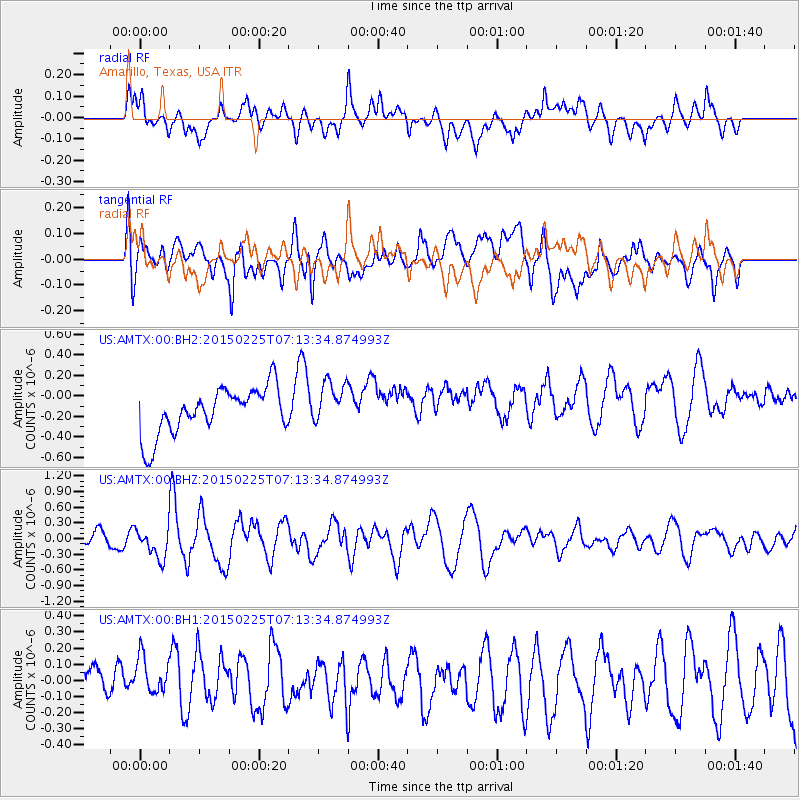
Signal To Noise
| Channel | StoN | STA | LTA |
| US:AMTX:00:BHZ:20150225T07:13:34.874993Z | 1.9353713 | 2.8975938E-7 | 1.4971774E-7 |
| US:AMTX:00:BH1:20150225T07:13:34.874993Z | 0.93852156 | 1.4489433E-7 | 1.5438573E-7 |
| US:AMTX:00:BH2:20150225T07:13:34.874993Z | 0.96005434 | 1.8933157E-7 | 1.9720922E-7 |
| Arrivals |
| Ps | |
| PpPs | |
| PsPs/PpSs | |


