You are here: Home > Network List > TA - USArray Transportable Network (new EarthScope stations) Stations List
> Station 435B Jarrell, TX, USA > Earthquake Result Viewer
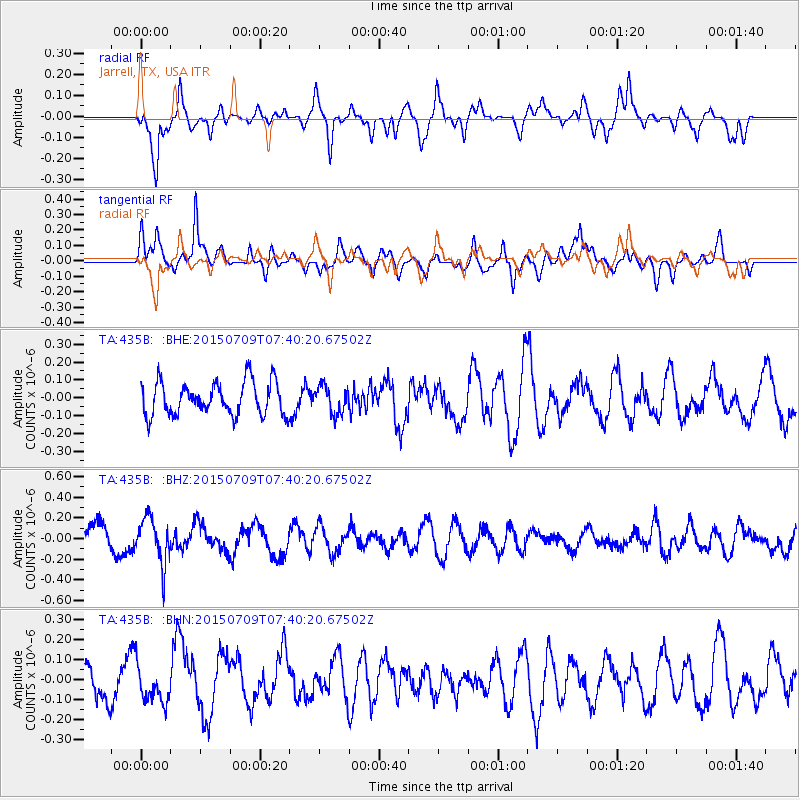
435B Jarrell, TX, USA - Earthquake Result Viewer
*The percent match for this event was below the threshold and hence no stack was calculated.
| Earthquake location: |
Fiji Islands Region |
| Earthquake latitude/longitude: |
-18.7/-177.1 |
| Earthquake time(UTC): |
2015/07/09 (190) 07:28:28 GMT |
| Earthquake Depth: |
352 km |
| Earthquake Magnitude: |
5.5 MW |
| Earthquake Catalog/Contributor: |
ISC/ISC |
|
| Network: |
TA USArray Transportable Network (new EarthScope stations) |
| Station: |
435B Jarrell, TX, USA |
| Lat/Lon: |
30.78 N/97.58 W |
| Elevation: |
248 m |
|
| Distance: |
90.8 deg |
| Az: |
57.822 deg |
| Baz: |
248.795 deg |
| Ray Param: |
$rayparam |
*The percent match for this event was below the threshold and hence was not used in the summary stack. |
|
| Radial Match: |
59.232857 % |
| Radial Bump: |
400 |
| Transverse Match: |
62.70205 % |
| Transverse Bump: |
400 |
| SOD ConfigId: |
7422571 |
| Insert Time: |
2019-04-19 17:28:28.519 +0000 |
| GWidth: |
2.5 |
| Max Bumps: |
400 |
| Tol: |
0.001 |
|
Signal To Noise
| Channel | StoN | STA | LTA |
| TA:435B: :BHZ:20150709T07:40:20.67502Z | 1.893141 | 2.1674475E-7 | 1.1448949E-7 |
| TA:435B: :BHN:20150709T07:40:20.67502Z | 1.0710155 | 9.367211E-8 | 8.746102E-8 |
| TA:435B: :BHE:20150709T07:40:20.67502Z | 0.82266104 | 7.594541E-8 | 9.231677E-8 |
| Arrivals |
| Ps | |
| PpPs | |
| PsPs/PpSs | |


