You are here: Home > Network List > US - United States National Seismic Network Stations List
> Station AMTX Amarillo, Texas, USA > Earthquake Result Viewer
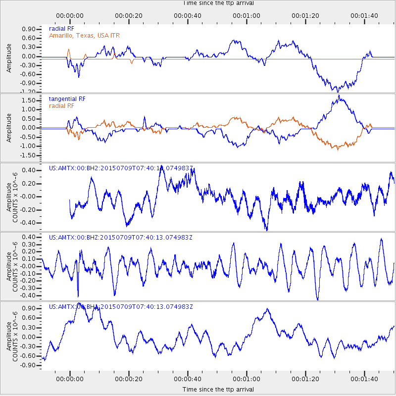
AMTX Amarillo, Texas, USA - Earthquake Result Viewer
*The percent match for this event was below the threshold and hence no stack was calculated.
| Earthquake location: |
Fiji Islands Region |
| Earthquake latitude/longitude: |
-18.7/-177.1 |
| Earthquake time(UTC): |
2015/07/09 (190) 07:28:28 GMT |
| Earthquake Depth: |
352 km |
| Earthquake Magnitude: |
5.5 MW |
| Earthquake Catalog/Contributor: |
ISC/ISC |
|
| Network: |
US United States National Seismic Network |
| Station: |
AMTX Amarillo, Texas, USA |
| Lat/Lon: |
34.53 N/101.41 W |
| Elevation: |
1010 m |
|
| Distance: |
89.2 deg |
| Az: |
53.144 deg |
| Baz: |
246.742 deg |
| Ray Param: |
$rayparam |
*The percent match for this event was below the threshold and hence was not used in the summary stack. |
|
| Radial Match: |
52.739513 % |
| Radial Bump: |
400 |
| Transverse Match: |
45.952606 % |
| Transverse Bump: |
400 |
| SOD ConfigId: |
7422571 |
| Insert Time: |
2019-04-19 17:29:38.897 +0000 |
| GWidth: |
2.5 |
| Max Bumps: |
400 |
| Tol: |
0.001 |
|
Signal To Noise
| Channel | StoN | STA | LTA |
| US:AMTX:00:BHZ:20150709T07:40:13.074983Z | 1.125168 | 1.4283836E-7 | 1.2694848E-7 |
| US:AMTX:00:BH1:20150709T07:40:13.074983Z | 5.7405543 | 1.3925481E-6 | 2.4258077E-7 |
| US:AMTX:00:BH2:20150709T07:40:13.074983Z | 2.3245697 | 3.7306188E-7 | 1.6048642E-7 |
| Arrivals |
| Ps | |
| PpPs | |
| PsPs/PpSs | |


