You are here: Home > Network List > US - United States National Seismic Network Stations List
> Station HAWA Hanford, Washington, USA > Earthquake Result Viewer
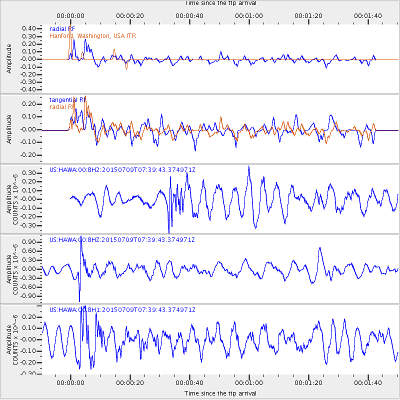
HAWA Hanford, Washington, USA - Earthquake Result Viewer
*The percent match for this event was below the threshold and hence no stack was calculated.
| Earthquake location: |
Fiji Islands Region |
| Earthquake latitude/longitude: |
-18.7/-177.1 |
| Earthquake time(UTC): |
2015/07/09 (190) 07:28:28 GMT |
| Earthquake Depth: |
352 km |
| Earthquake Magnitude: |
5.5 MW |
| Earthquake Catalog/Contributor: |
ISC/ISC |
|
| Network: |
US United States National Seismic Network |
| Station: |
HAWA Hanford, Washington, USA |
| Lat/Lon: |
46.39 N/119.53 W |
| Elevation: |
364 m |
|
| Distance: |
83.0 deg |
| Az: |
36.067 deg |
| Baz: |
233.738 deg |
| Ray Param: |
$rayparam |
*The percent match for this event was below the threshold and hence was not used in the summary stack. |
|
| Radial Match: |
62.262196 % |
| Radial Bump: |
400 |
| Transverse Match: |
53.74551 % |
| Transverse Bump: |
400 |
| SOD ConfigId: |
7422571 |
| Insert Time: |
2019-04-19 17:29:41.784 +0000 |
| GWidth: |
2.5 |
| Max Bumps: |
400 |
| Tol: |
0.001 |
|
Signal To Noise
| Channel | StoN | STA | LTA |
| US:HAWA:00:BHZ:20150709T07:39:43.374971Z | 2.9021125 | 4.1118392E-7 | 1.4168435E-7 |
| US:HAWA:00:BH1:20150709T07:39:43.374971Z | 1.6993666 | 1.6227298E-7 | 9.549028E-8 |
| US:HAWA:00:BH2:20150709T07:39:43.374971Z | 2.1746395 | 1.390181E-7 | 6.392696E-8 |
| Arrivals |
| Ps | |
| PpPs | |
| PsPs/PpSs | |


