You are here: Home > Network List > TA - USArray Transportable Network (new EarthScope stations) Stations List
> Station R11A Troy Canyon, Currant, NV, USA > Earthquake Result Viewer
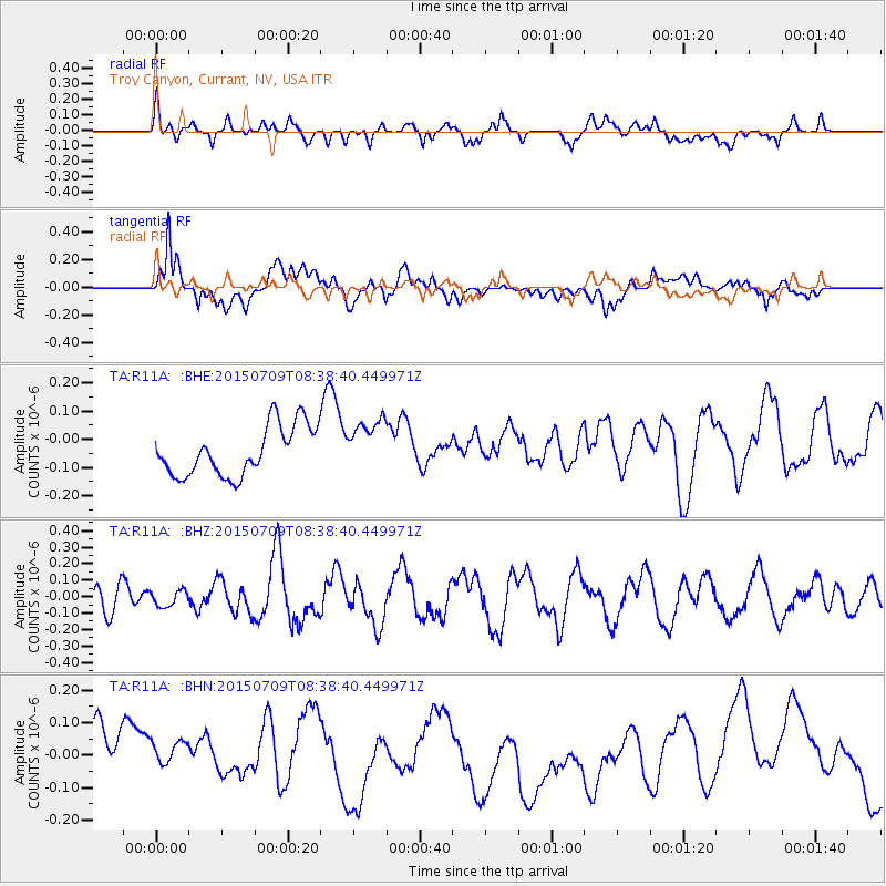
R11A Troy Canyon, Currant, NV, USA - Earthquake Result Viewer
*The percent match for this event was below the threshold and hence no stack was calculated.
| Earthquake location: |
Near East Coast Of Honshu, Japan |
| Earthquake latitude/longitude: |
40.1/142.6 |
| Earthquake time(UTC): |
2015/07/09 (190) 08:27:38 GMT |
| Earthquake Depth: |
36 km |
| Earthquake Magnitude: |
5.3 MW |
| Earthquake Catalog/Contributor: |
ISC/ISC |
|
| Network: |
TA USArray Transportable Network (new EarthScope stations) |
| Station: |
R11A Troy Canyon, Currant, NV, USA |
| Lat/Lon: |
38.35 N/115.59 W |
| Elevation: |
1756 m |
|
| Distance: |
74.2 deg |
| Az: |
53.116 deg |
| Baz: |
308.729 deg |
| Ray Param: |
$rayparam |
*The percent match for this event was below the threshold and hence was not used in the summary stack. |
|
| Radial Match: |
55.747974 % |
| Radial Bump: |
400 |
| Transverse Match: |
41.893562 % |
| Transverse Bump: |
400 |
| SOD ConfigId: |
7422571 |
| Insert Time: |
2019-04-19 17:38:24.505 +0000 |
| GWidth: |
2.5 |
| Max Bumps: |
400 |
| Tol: |
0.001 |
|
Signal To Noise
| Channel | StoN | STA | LTA |
| TA:R11A: :BHZ:20150709T08:38:40.449971Z | 0.6197849 | 4.8008438E-8 | 7.745984E-8 |
| TA:R11A: :BHN:20150709T08:38:40.449971Z | 0.8853753 | 7.8011E-8 | 8.811065E-8 |
| TA:R11A: :BHE:20150709T08:38:40.449971Z | 1.0697117 | 9.37326E-8 | 8.762417E-8 |
| Arrivals |
| Ps | |
| PpPs | |
| PsPs/PpSs | |


