You are here: Home > Network List > TA - USArray Transportable Network (new EarthScope stations) Stations List
> Station I23K Minto, Yukon-Koyukuk, AK, USA > Earthquake Result Viewer
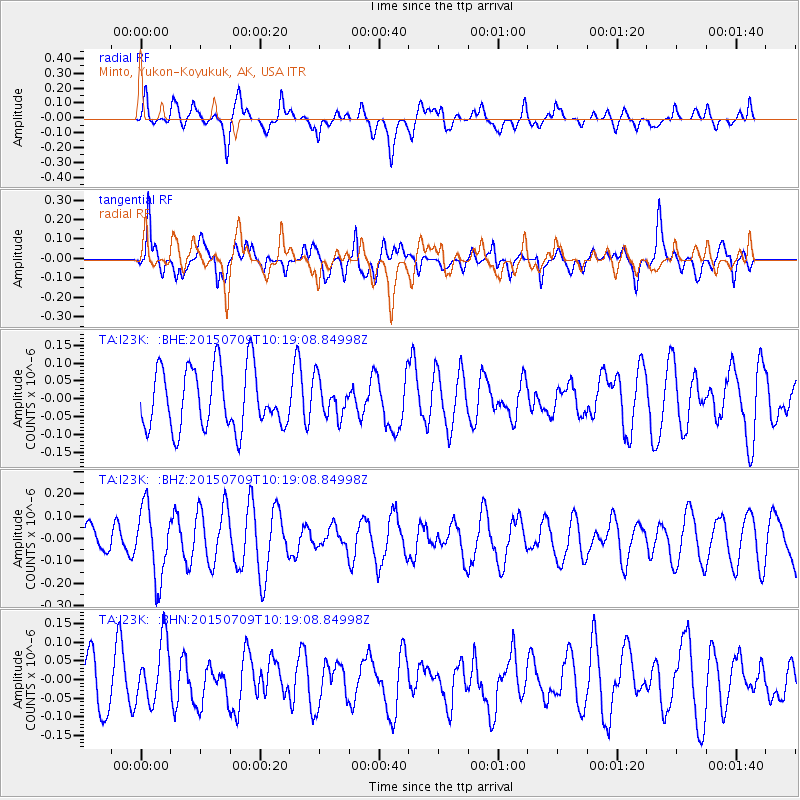
I23K Minto, Yukon-Koyukuk, AK, USA - Earthquake Result Viewer
*The percent match for this event was below the threshold and hence no stack was calculated.
| Earthquake location: |
New Ireland Region, P.N.G. |
| Earthquake latitude/longitude: |
-4.3/153.5 |
| Earthquake time(UTC): |
2015/07/09 (190) 10:07:38 GMT |
| Earthquake Depth: |
107 km |
| Earthquake Magnitude: |
5.2 MW |
| Earthquake Catalog/Contributor: |
ISC/ISC |
|
| Network: |
TA USArray Transportable Network (new EarthScope stations) |
| Station: |
I23K Minto, Yukon-Koyukuk, AK, USA |
| Lat/Lon: |
65.15 N/149.36 W |
| Elevation: |
149 m |
|
| Distance: |
80.7 deg |
| Az: |
21.088 deg |
| Baz: |
238.106 deg |
| Ray Param: |
$rayparam |
*The percent match for this event was below the threshold and hence was not used in the summary stack. |
|
| Radial Match: |
60.915375 % |
| Radial Bump: |
400 |
| Transverse Match: |
41.488724 % |
| Transverse Bump: |
397 |
| SOD ConfigId: |
7422571 |
| Insert Time: |
2019-04-19 17:43:44.179 +0000 |
| GWidth: |
2.5 |
| Max Bumps: |
400 |
| Tol: |
0.001 |
|
Signal To Noise
| Channel | StoN | STA | LTA |
| TA:I23K: :BHZ:20150709T10:19:08.84998Z | 2.1713018 | 1.5678147E-7 | 7.2206205E-8 |
| TA:I23K: :BHN:20150709T10:19:08.84998Z | 0.8133174 | 8.211873E-8 | 1.00967625E-7 |
| TA:I23K: :BHE:20150709T10:19:08.84998Z | 0.6050772 | 5.1340503E-8 | 8.484951E-8 |
| Arrivals |
| Ps | |
| PpPs | |
| PsPs/PpSs | |


